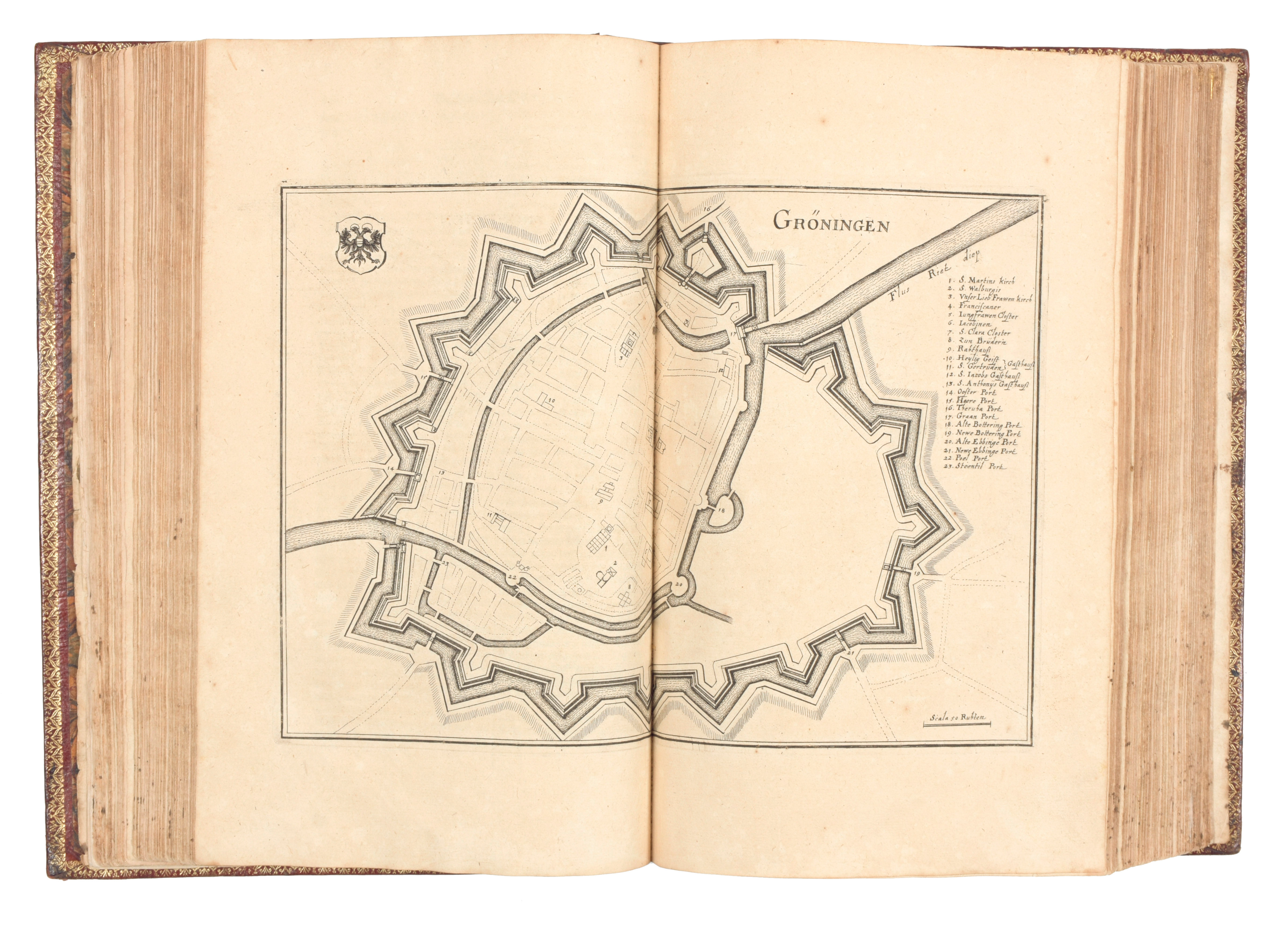
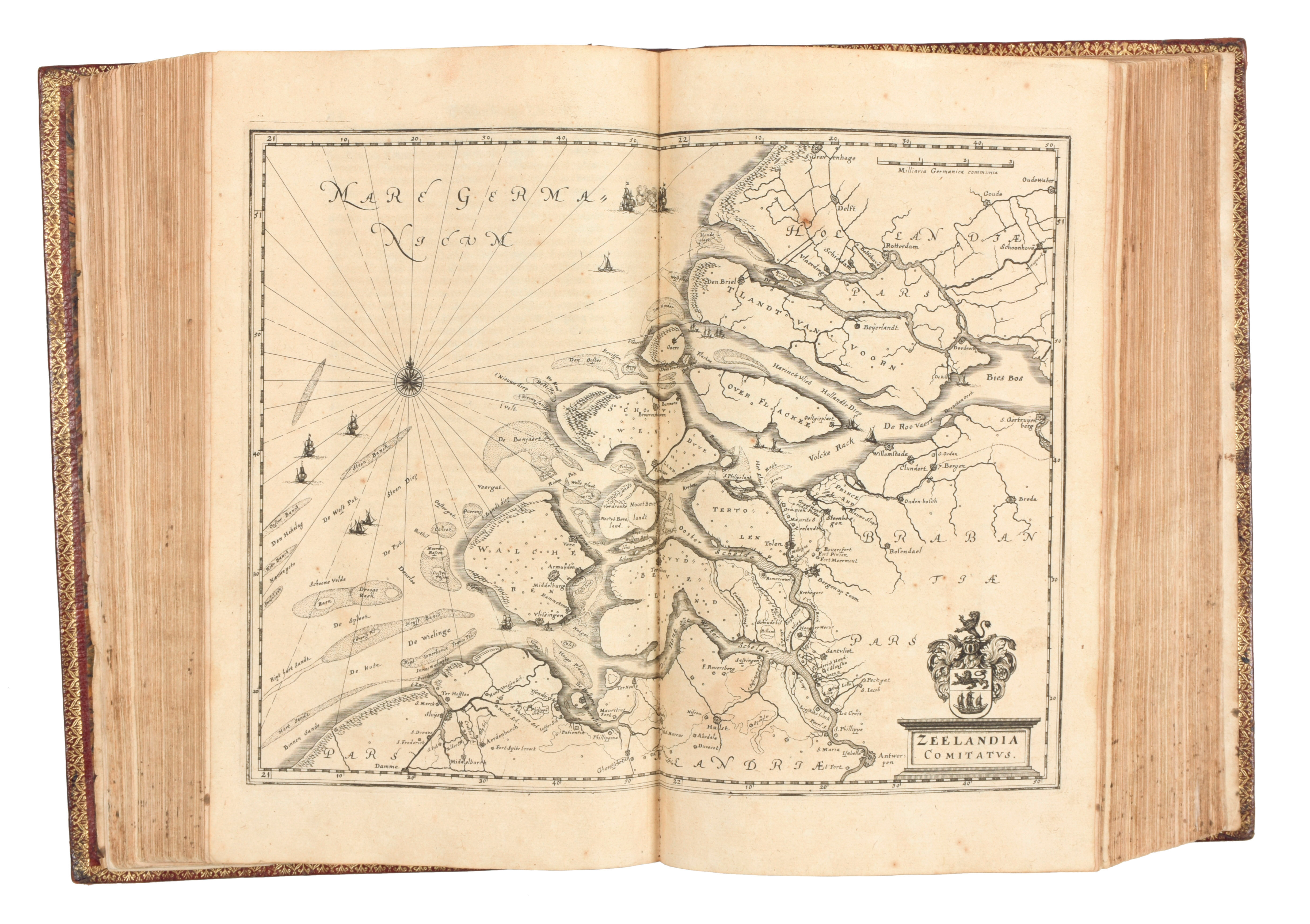
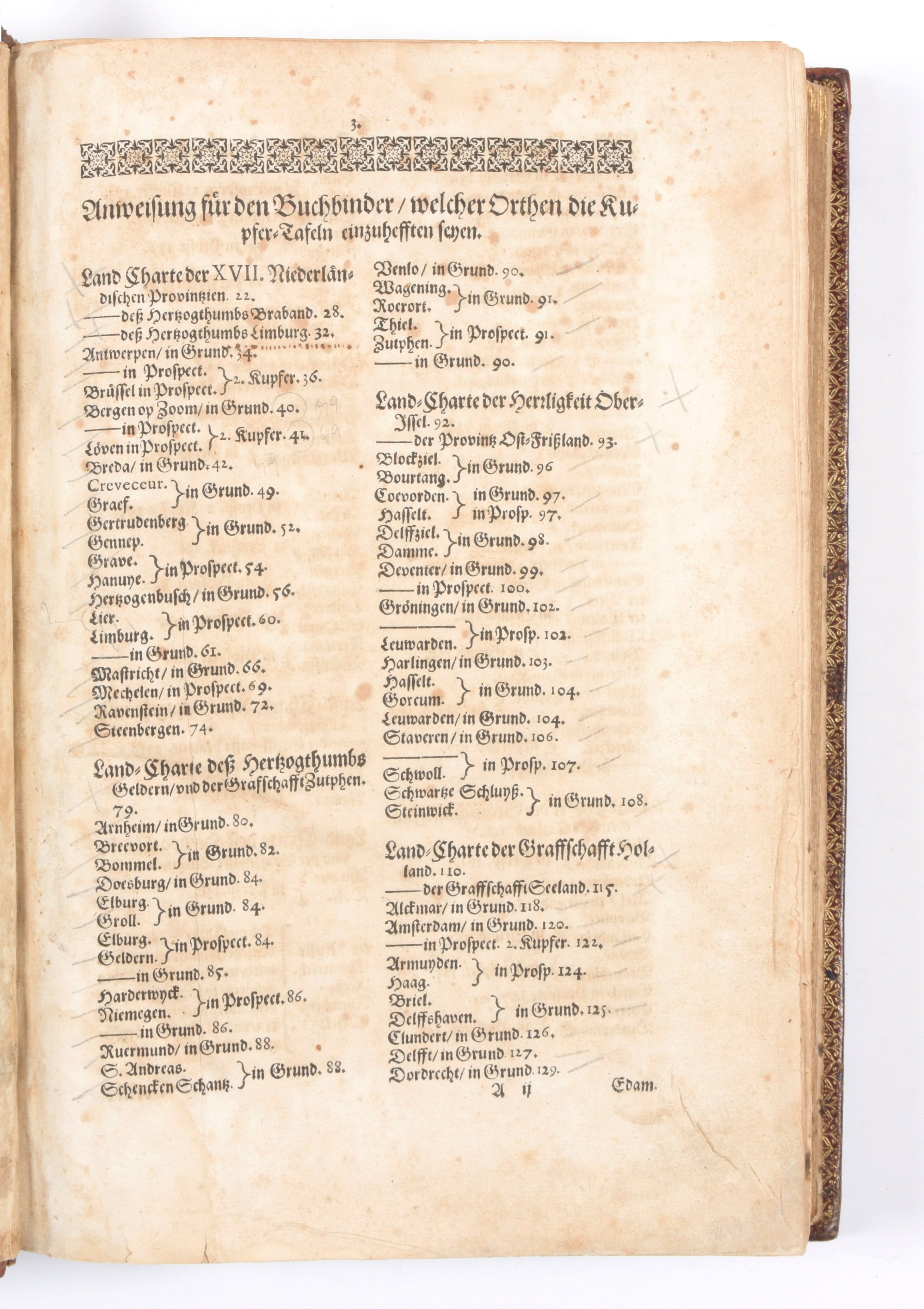
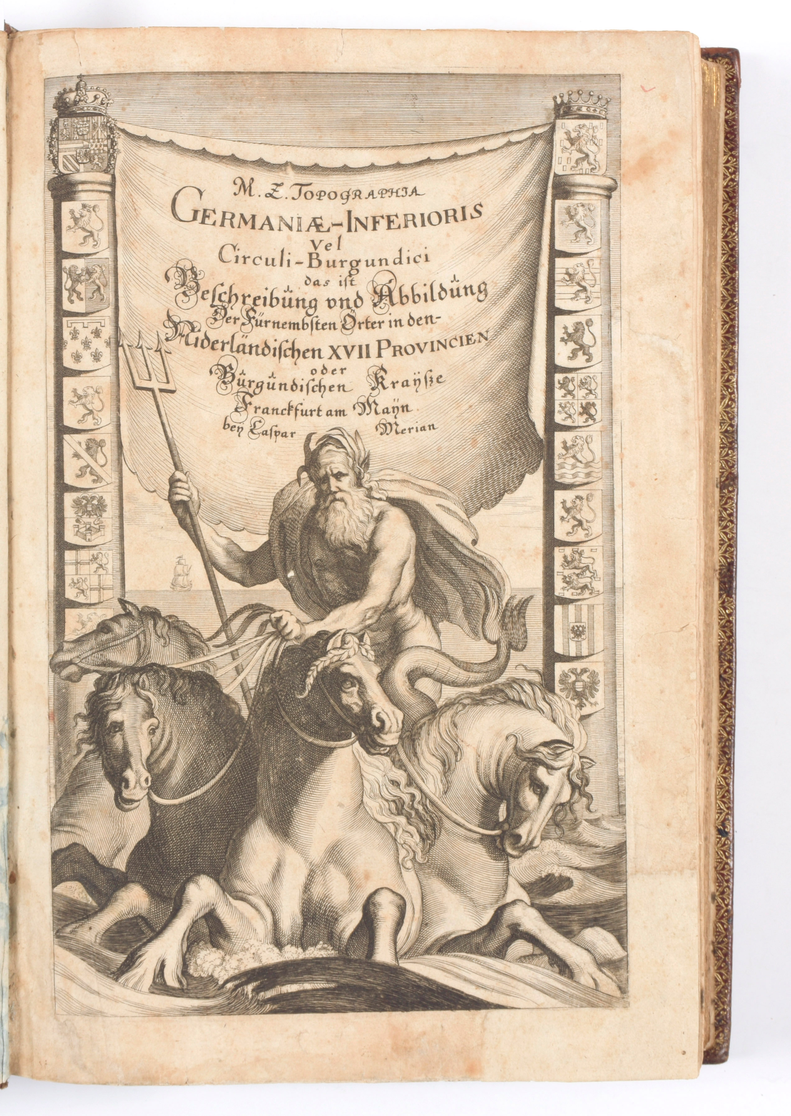
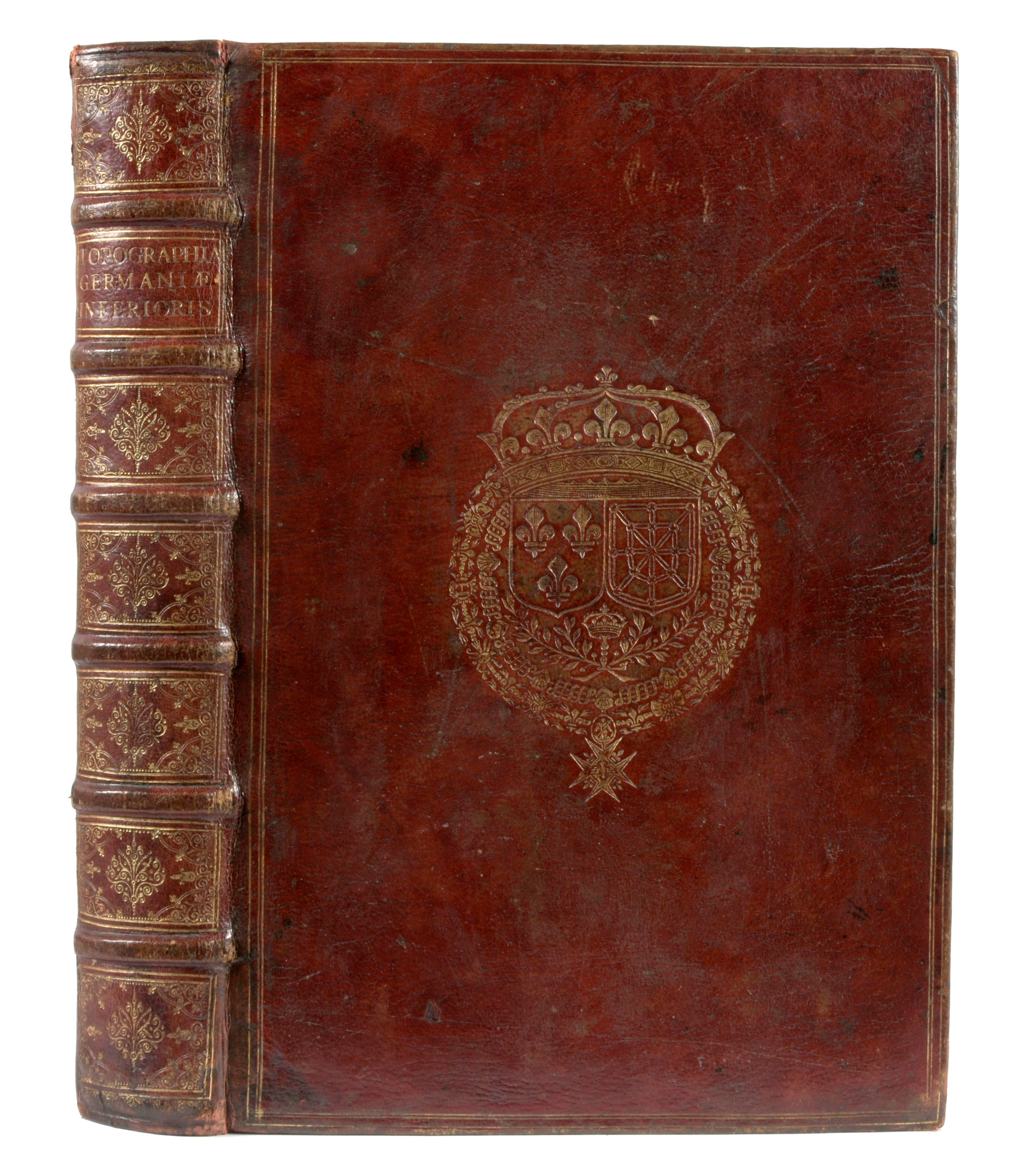
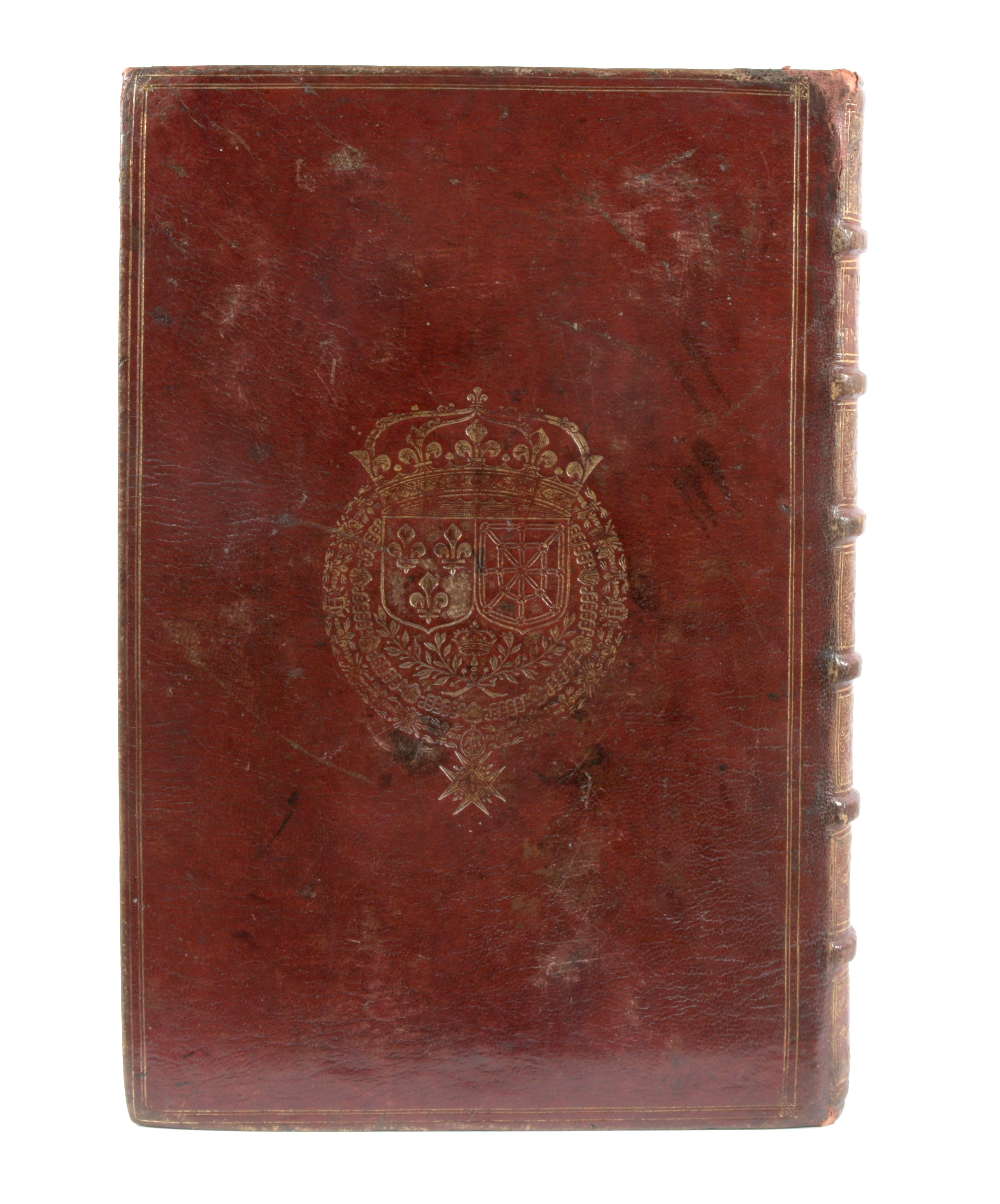
Folio, 283-[20-1 bl.] pp. Engr. ills : title with Neptune, dolphins and coats-of-arms, 12 double-page maps, 65 views and 91 city maps (1 pl. from another ed. or vol.) on 119 pls (lacking the view of Lier/Limburg but added the map of Zwolle). Some names written in ink on the city maps. (browning throughout, some staining & foxing, sm. marg. tears in t.-p., large tear in views (Amsterdam & Rotterdam, Antwerp) repaired, some views trimmed to plate border, marg. inkstain at top of last quires). Copy in a remarkable binding: rich goldtooled burgundy morocco armorial binding (sl. rubbed, corners sl. rubbed), double gilt-ruled covers with central gilt arms on both boards (sl. stained back cover), richly gilt spine on 6 raised bands (sl. rubbed at top), gilt sides, gilt inside dentelles, marbl. endpapers (stained borders, hole), The dedication leaves (2 ff.) are bound at the end. Martin Zeiller (1589-1661) compiled similar volumes for Caspar Merian (1655-c. 1680). Some marg. ms. notes in ink. The arms of France and of Navarre on covers belong to Louis XIII (1601-1643), King of France (1610-1643), son of Henri IV
Later edition (1st 1659) of the splendid description of the Low Countries, with a wealth of information (and maps) on larger and smaller towns, incl. Breda, Haarlem, Rotterdam, Brussels, Leuven, Lier, Mechelen, Brugge, Dendermonde, Geraardsbergen, Kortrijk, Gent, Oostende, Cambrai, Luxemburg, ... Ref. Schuchhard, nr. 69