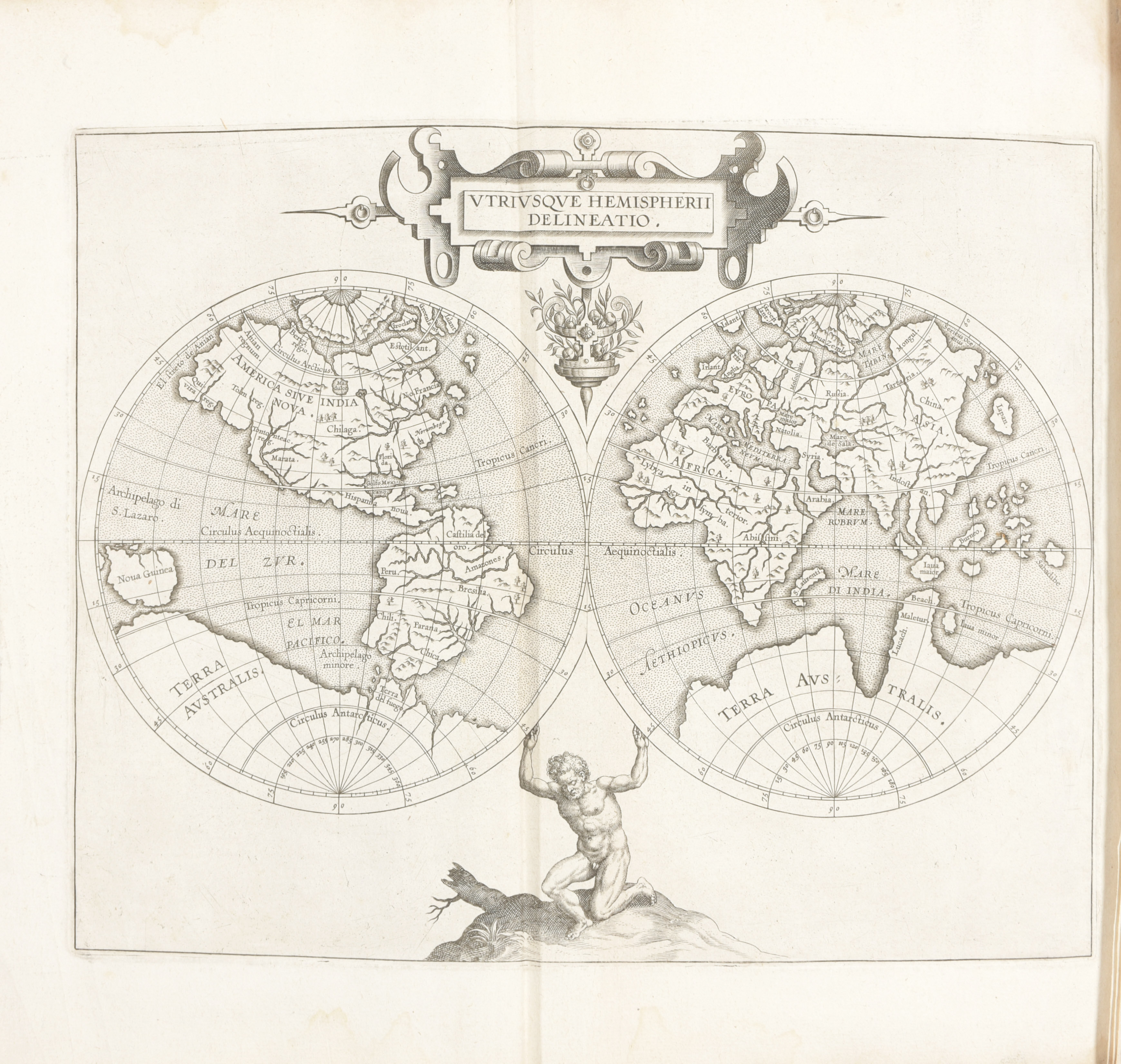
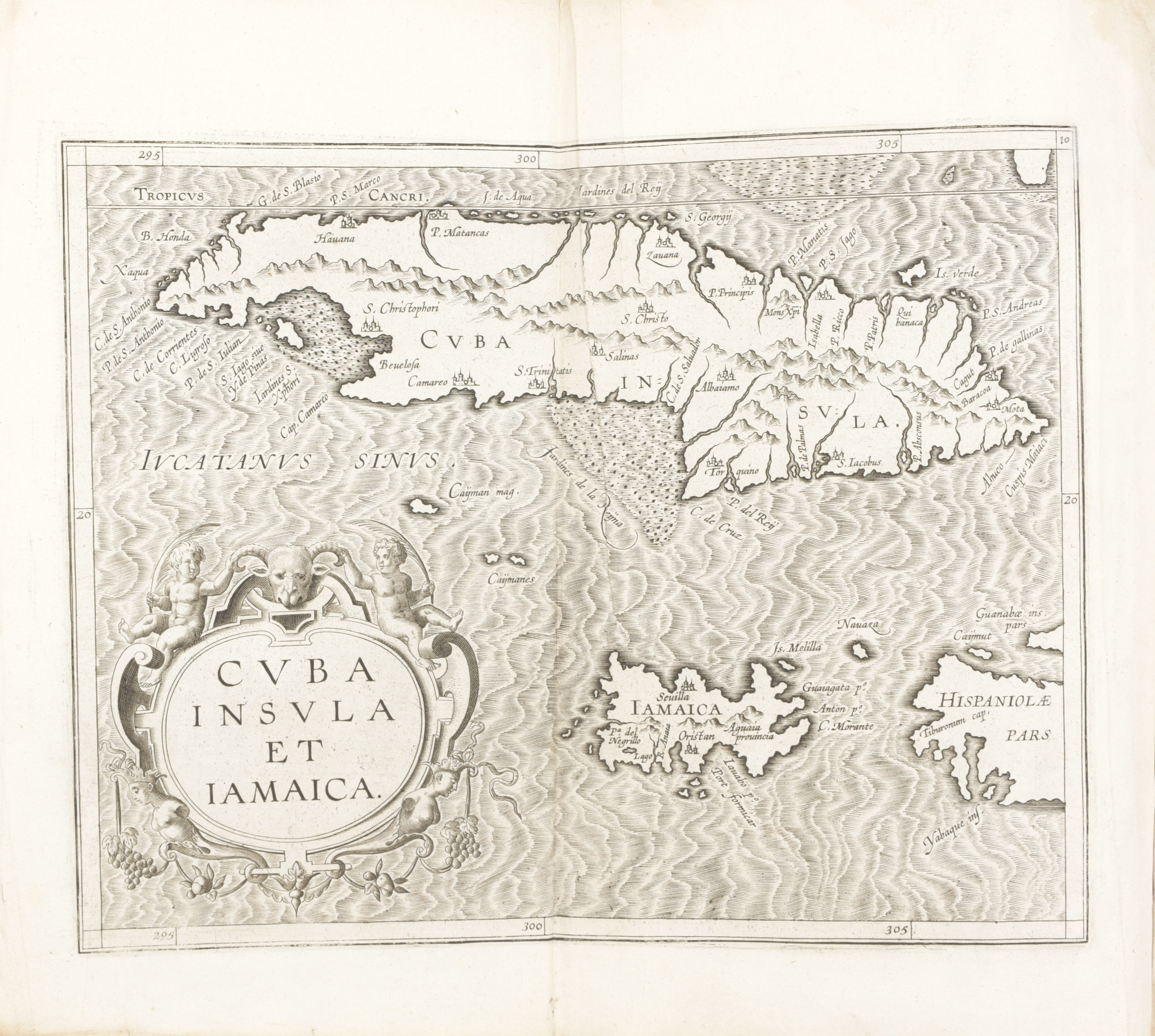
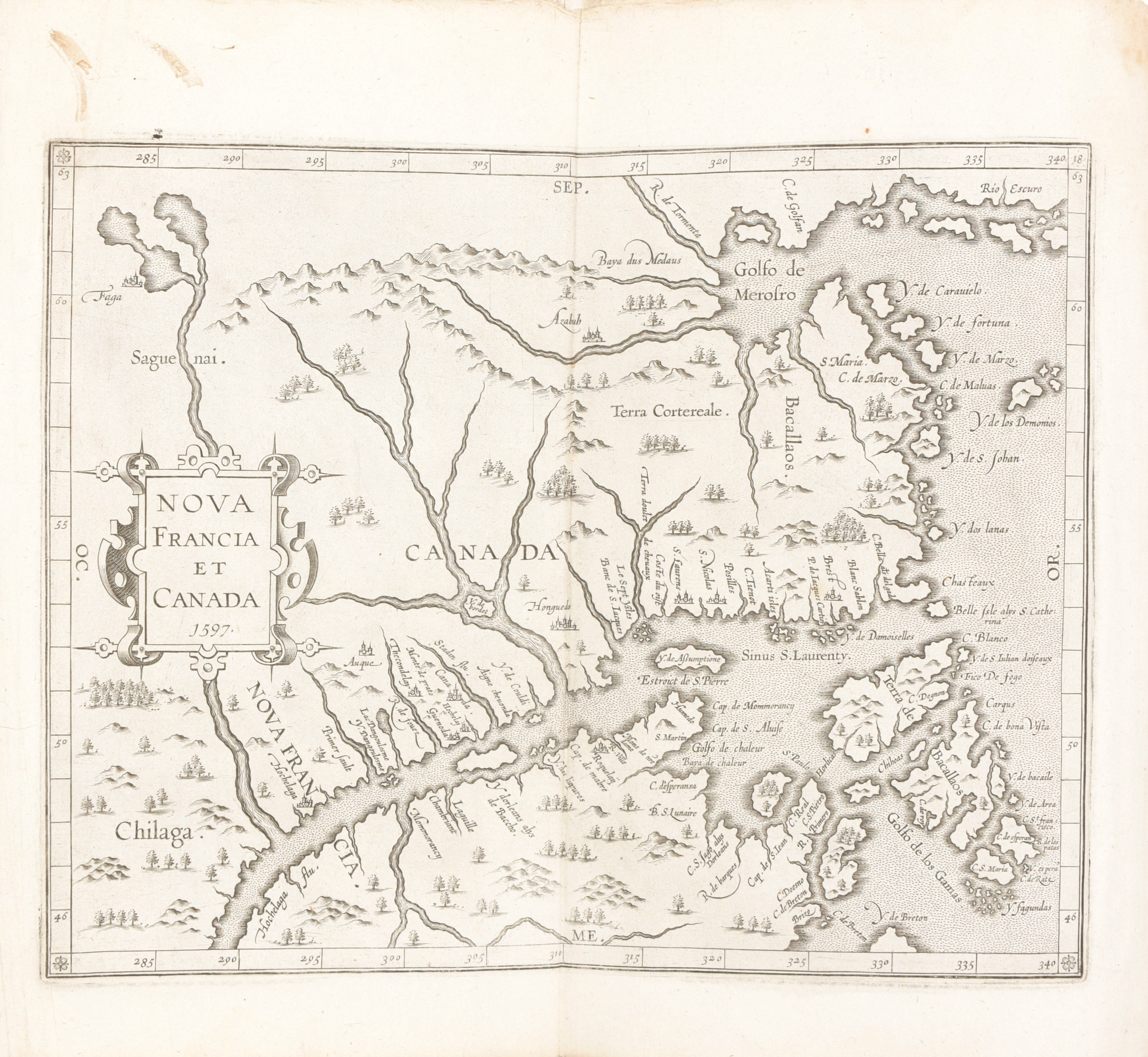
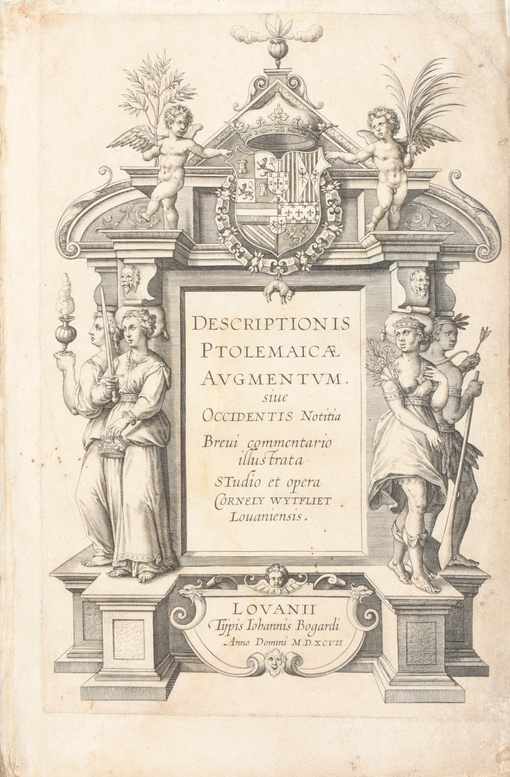
In-folio (303 x 197 mm). [viii], 191, [1] pages. Engraved allegorical title and 19 engraved folding maps, woodcut initials and tail-pieces, typographic head-pieces, privilege leaf from the first edition. All maps are present, but in a different order than the index announces. There is 1 world map and 18 regional maps of the Americas: Brazil, California, Canada (3), Chile, Colombia, Cuba, Florida, Haiti, Mexico, Northwest, Rio de la Plata, Southern hemisphere, Peru, Venezuela, Virginia and Yucatán. Condition: lacking one preliminary leaf containing epigrams on the author, first two leaves slightly shorter at lower margin, minor marginal repairs in title and last map, light dampstain at some corners with a little weakness and a single wormhole at top gutter, the first 4 maps with small tear-off to upper blank margin. Recased in old limp vellum over modern pasteboard (soiled, pen-trials, traces of closing ties)
Second, enlarged and corrected edition of the FIRST ATLAS OF THE AMERICAS, containing the first printed map of present-day central Canada - the first to use 'CANADA' in its title; the most accurate map of the North American east coast up to 1620 - the second to use Virginia in the title; the first cartographic engraving devoted exclusively to BRAZIL, and the first map devoted to CALIFORNIA and the southwest USA (cf. Burden). Derived from a variety of sources, the maps represent cartographic knowledge from the voyages of Frobisher and Davis, De Soto and others, and the text gives a history of the voyages of Columbus, Cabot, Verrazzano and others, as well as a description of the natural history and ethnography of these lands. Two editions were printed in 1597 easily distinguished by the number of leaves. The first edition was printed in a smaller type on 51 leaves and the present edition in a larger type on 100 leaves, with some additional text, including a dedication to Philip III of Spain and a leaf of epigrams on the author by Sicamber. The maps are identical in both (and immediately succeeding) editions. Four maps are known in variant states; in the present copy Burden 100 is in the 3rd state and Burden 102, 103 and 107 are in the first state. The sheets of the second edition were re-issued in 1598 with the same engraved title-page updated to 1598. Ref. Adams W278; Shirley T.WYT-1a; Alden & Landis 597/70; Burden I, 100-107; Gallup, 'Wytfliet's ""Descriptionis Ptolemaicae Augmentum""', PBSA 1982: 63-73; Koeman IV, Wyt 1B and Van der Krogt 371:02; Sabin 105696 (note); Schwartz and Ehrenberg, America, p. 83; Skelton, Wytfliet 1964; see Borba de Moraes II, 946