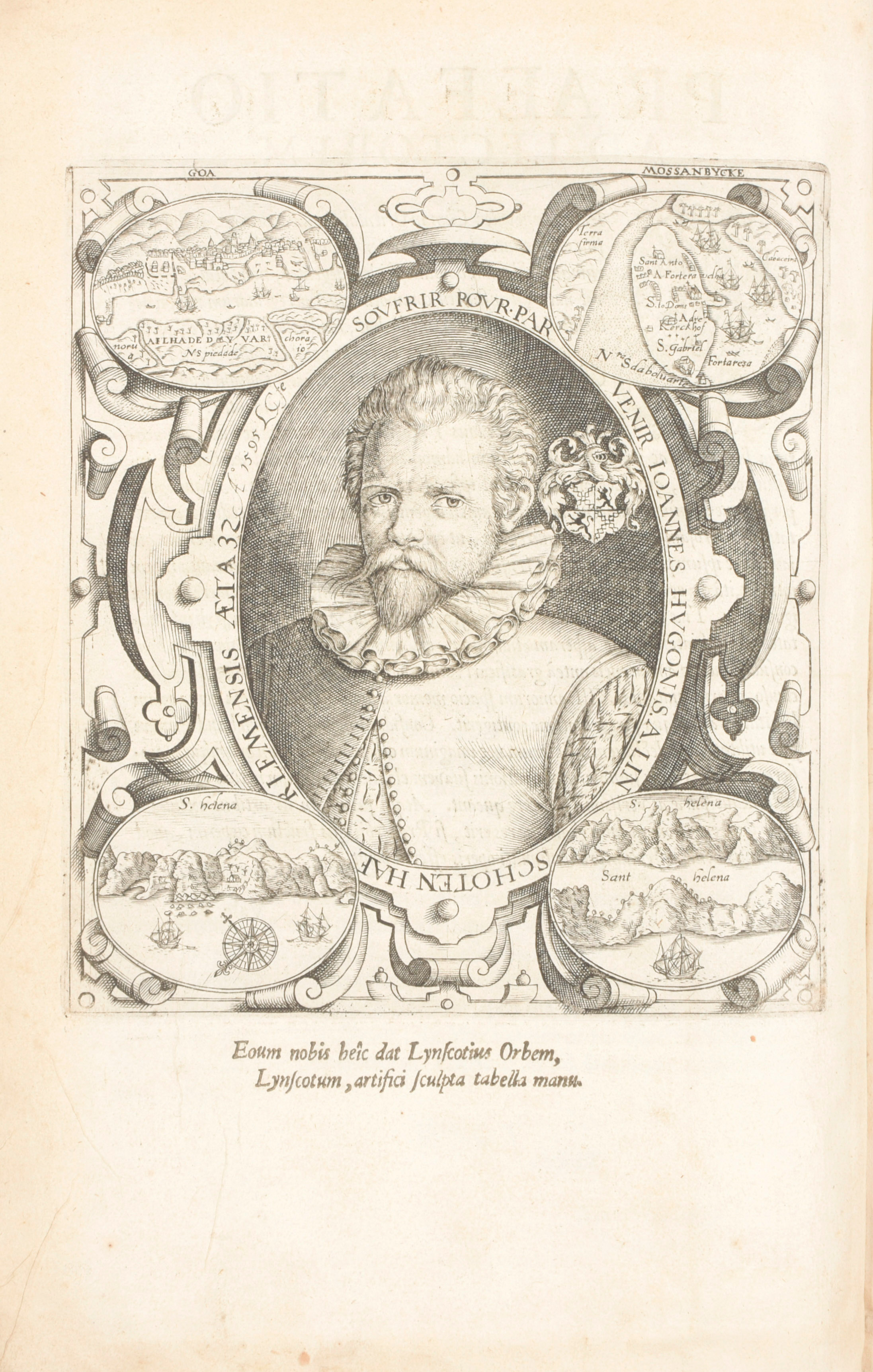
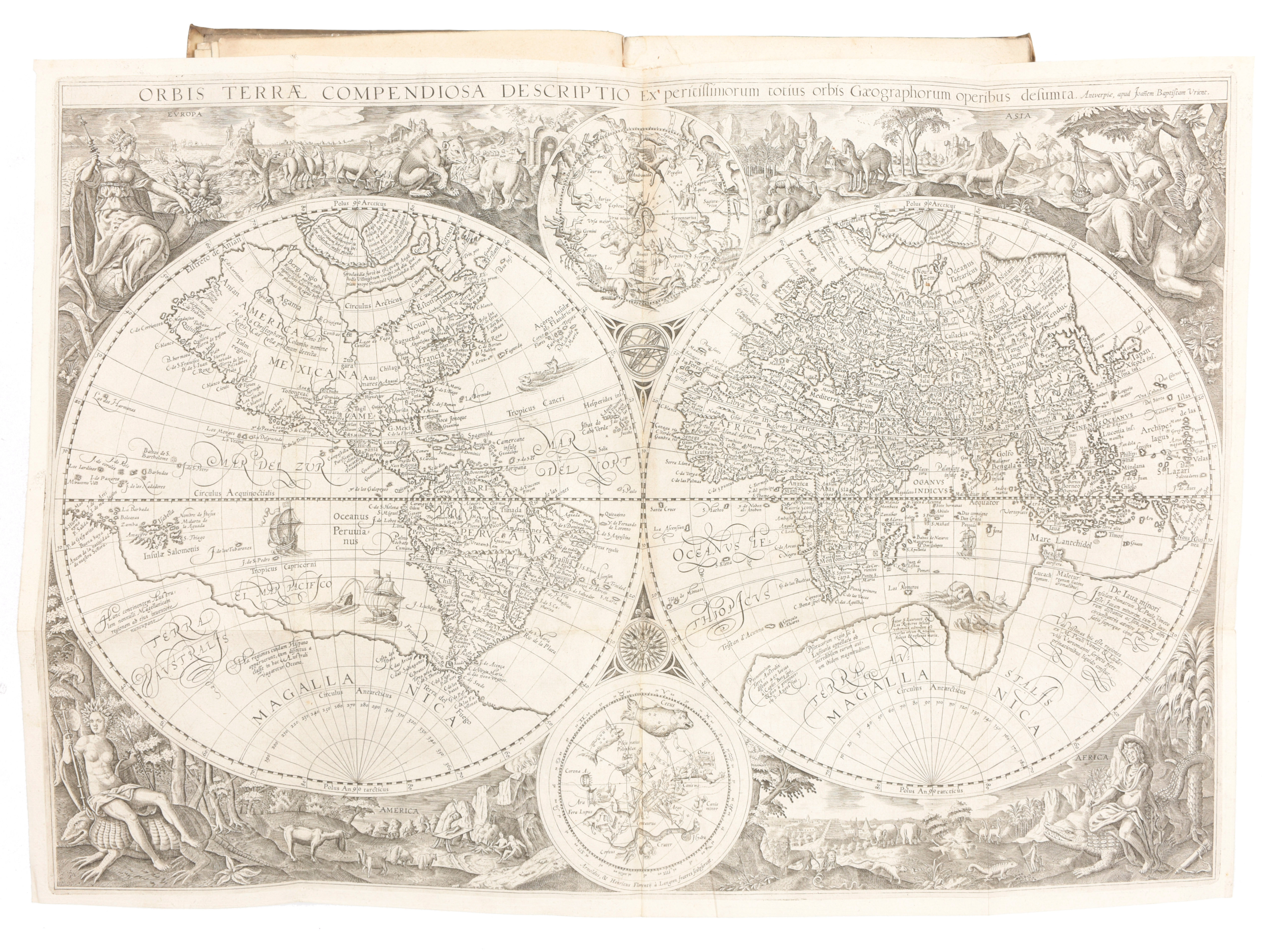
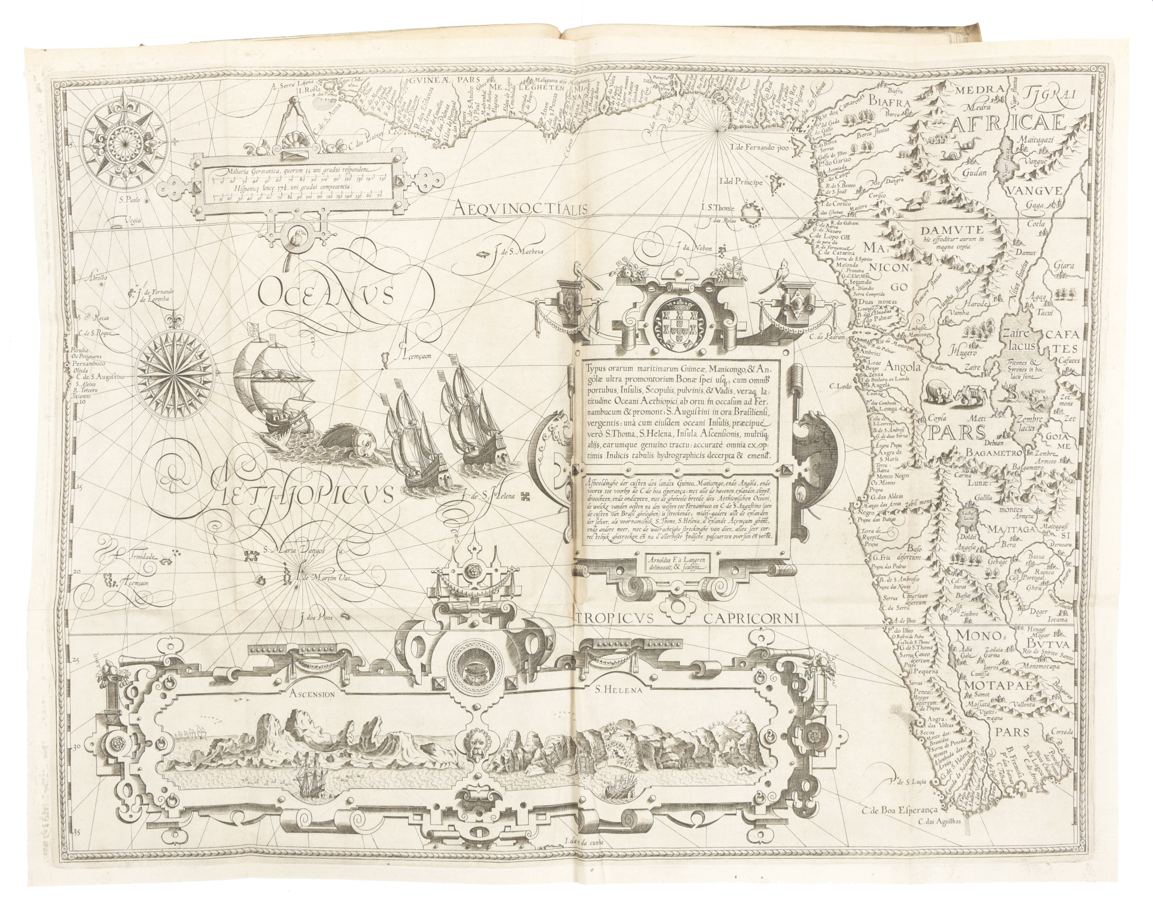
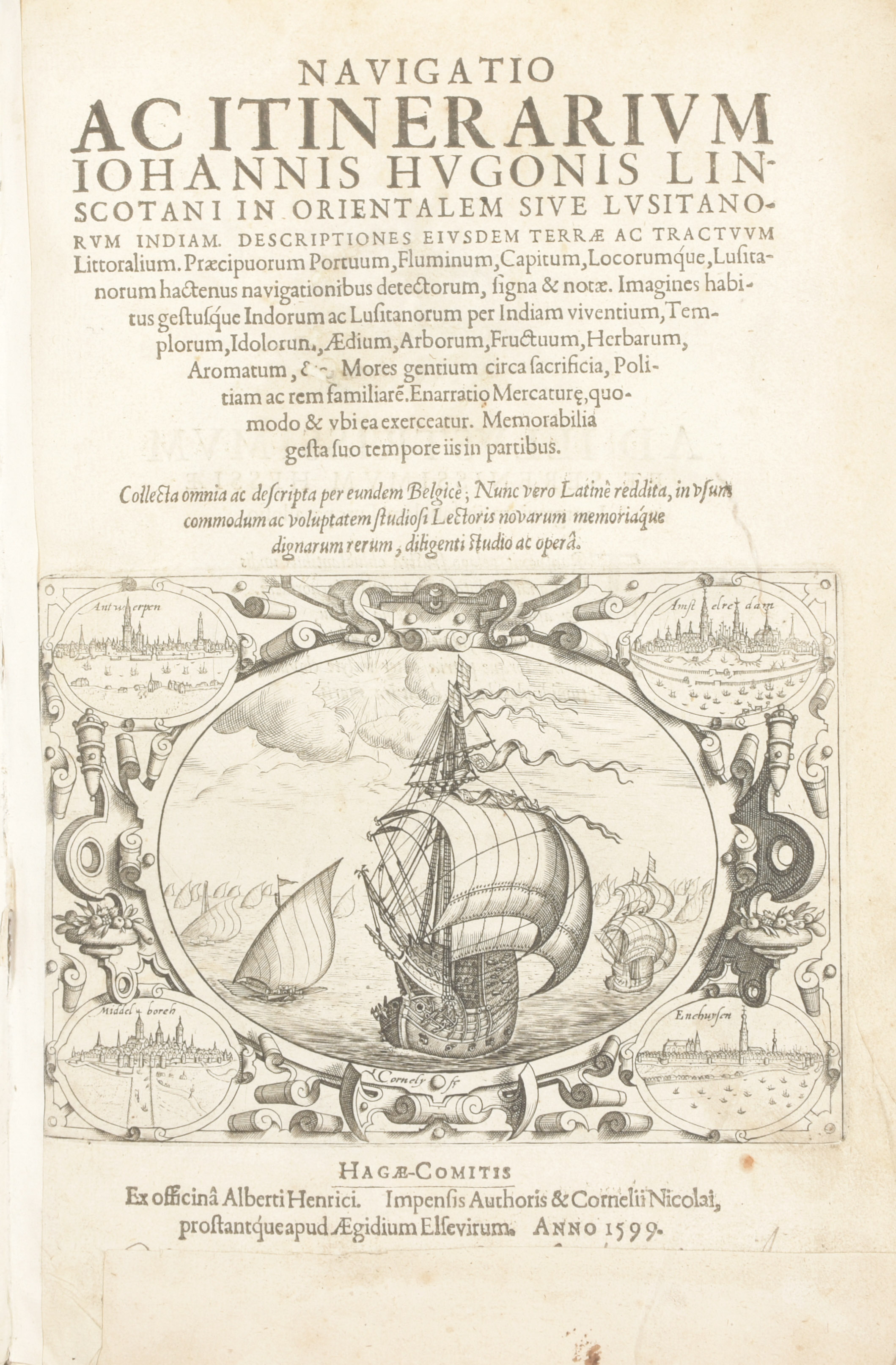
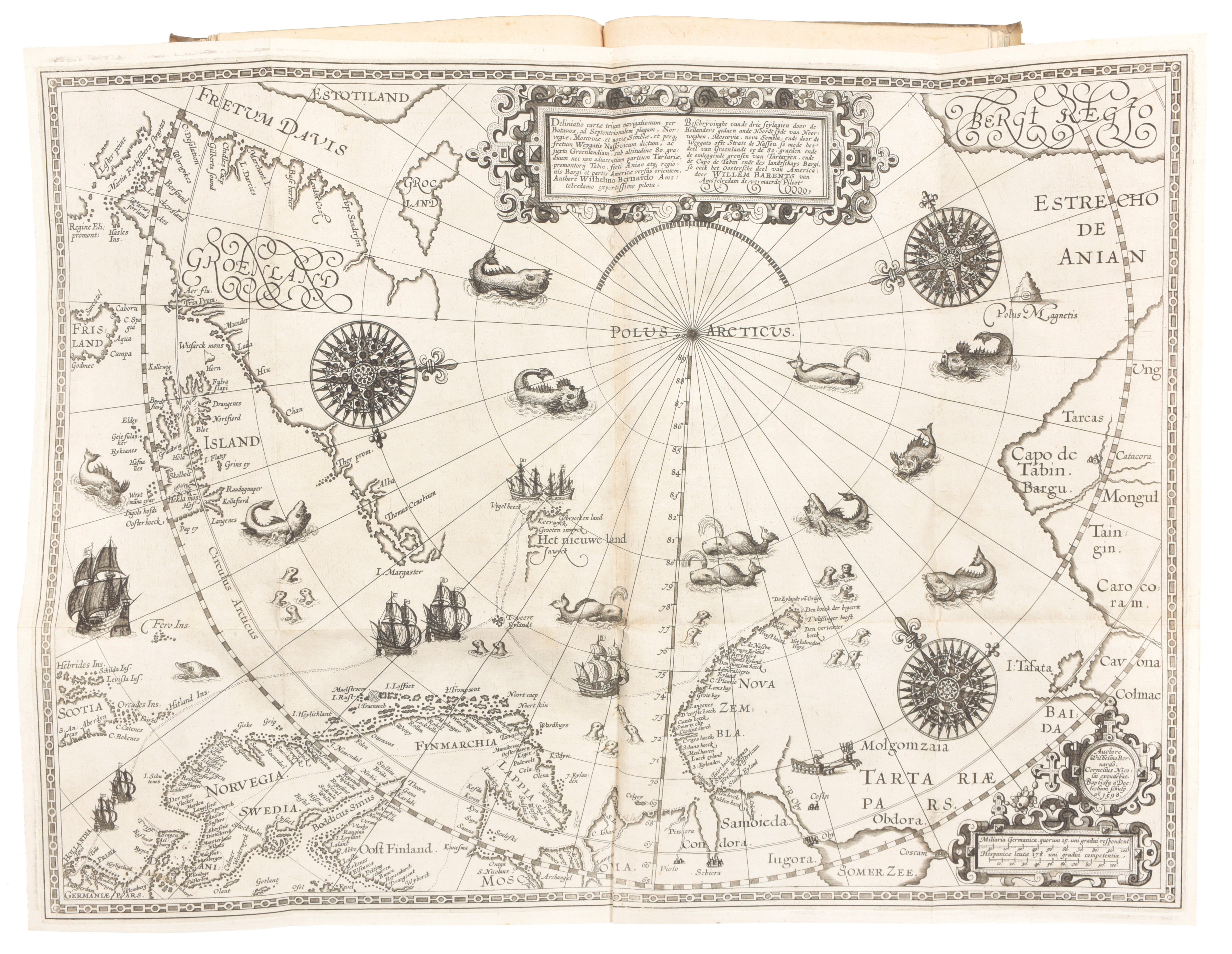
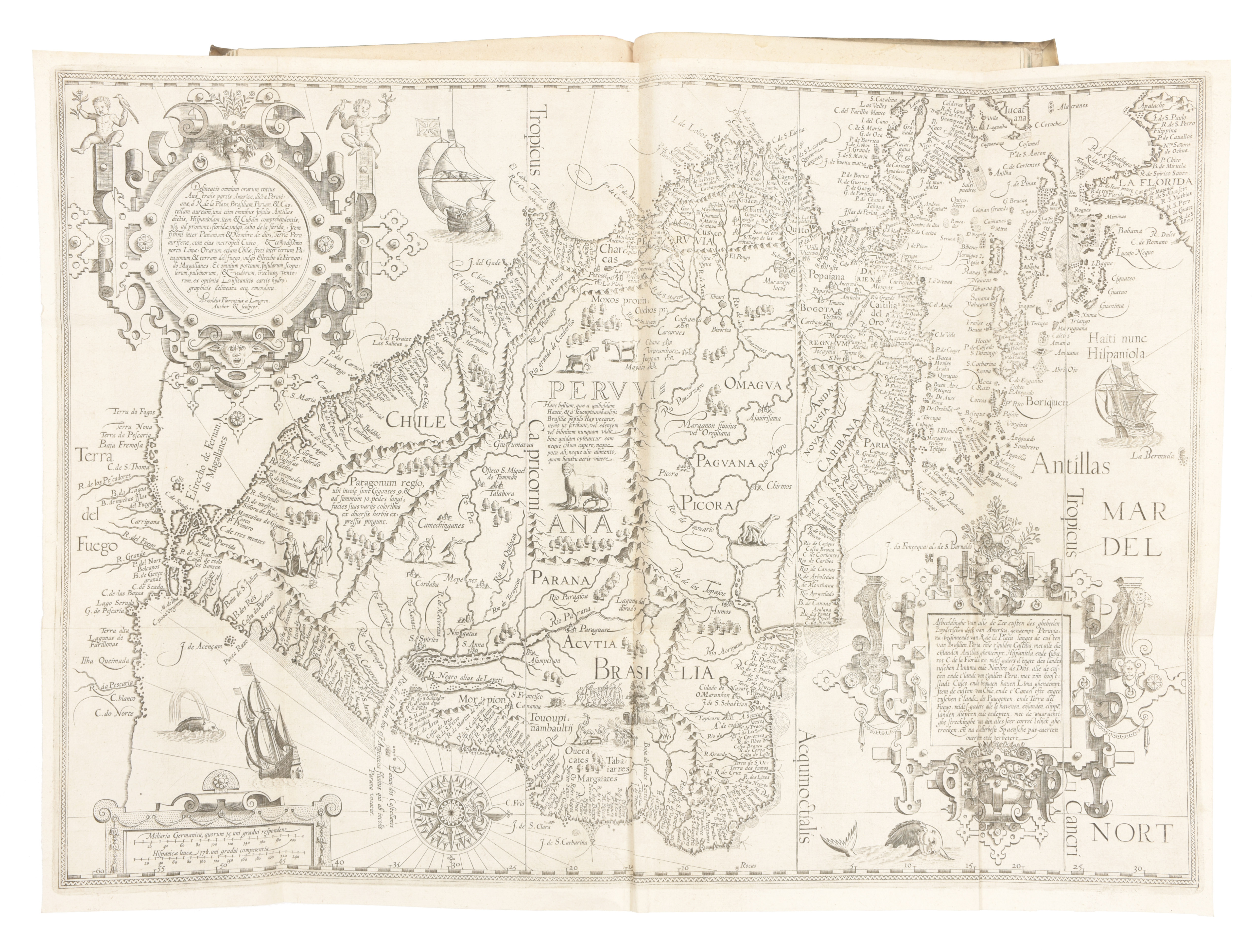
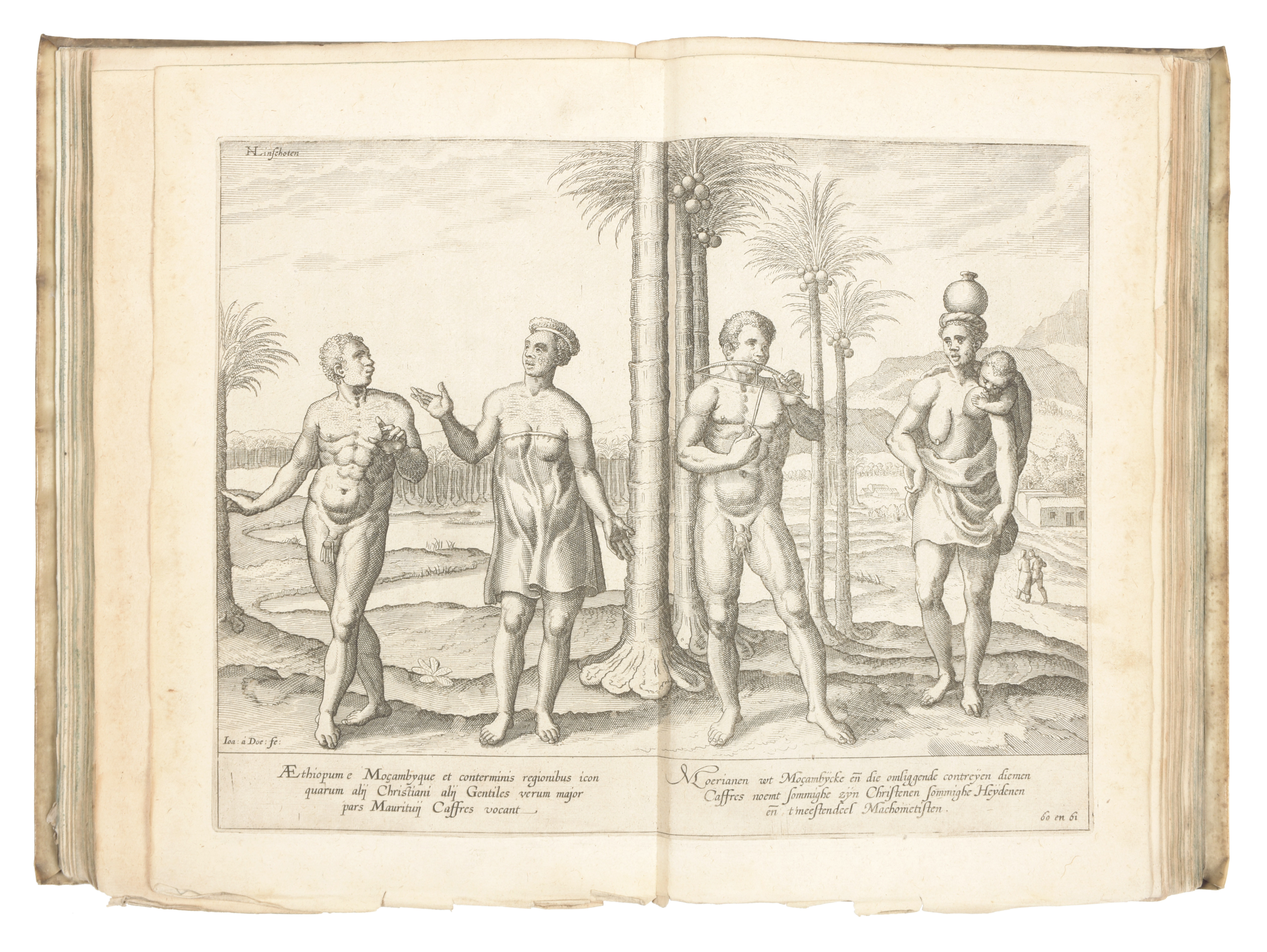
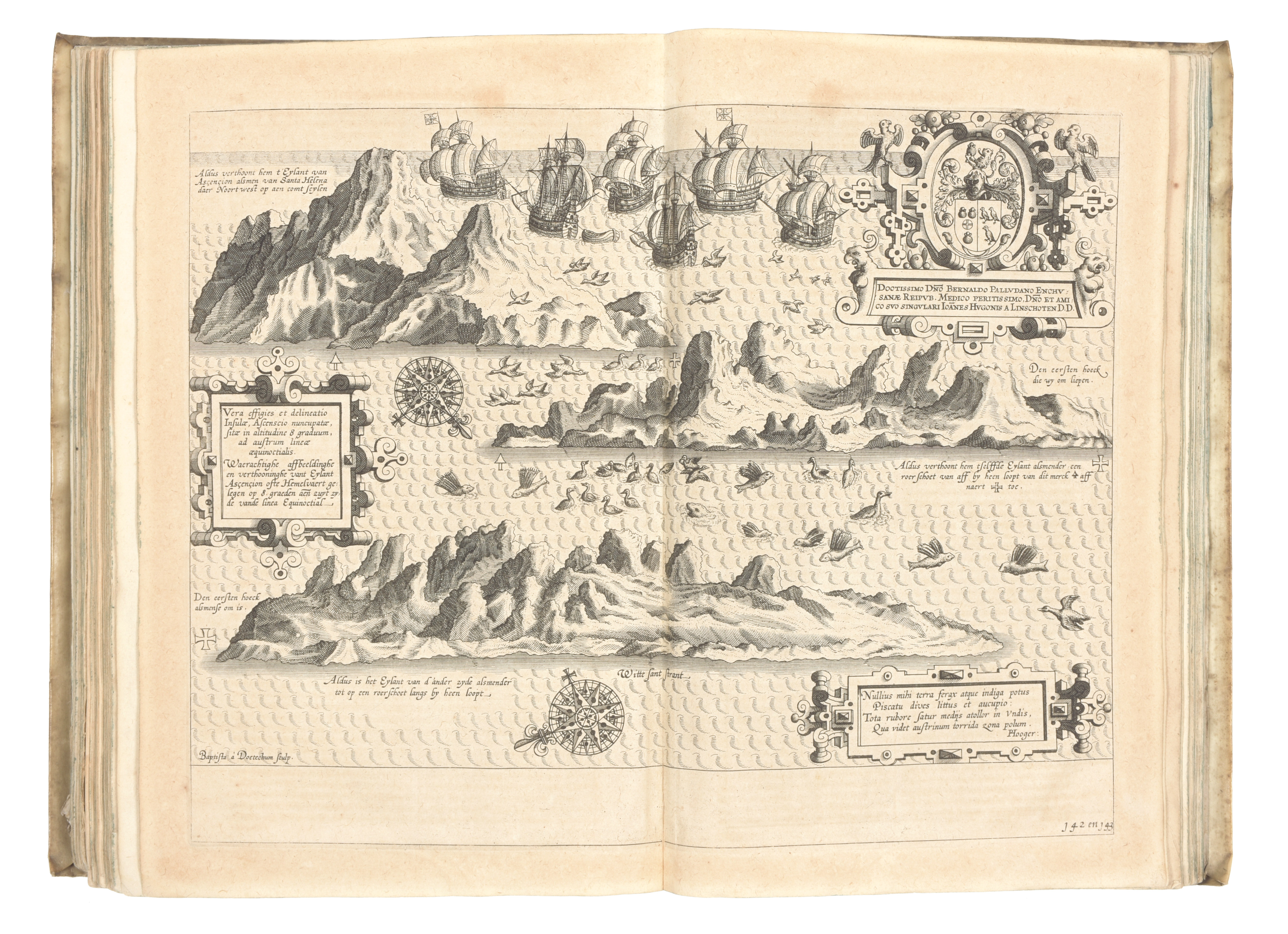
2 parts in 1 vol. in-folio (310 x 200 mm), viii, 124, 45, [3] pp. Title to each part with large ship-vignette, full-page engraved illustration of dedicatee's arms, full-page engraved PORTRAIT of the author with four small inset maps at corners, 7 folding engraved maps (WORLD MAP by Arnold and Hendrik van Langren after Jan Baptist Vrients ; East Coast of Africa; Coast around Indian Ocean; Coasts of China, Sumatra & Java ; West Coast of Africa ; ARCTIC OCEAN; Central & South American Coasts), 31 plates (costumes and botanical subjects), 5 folding plates (City of Goa, Market of Goa, two of Sancta Helena, City of Angra). The plates are signed by Baptista van Doetecum and Jan van Doetecum the younger, others by Arnold Florensz. van Langren, and Hendrik Florensz. van Langren, after Willem Barents, A.F. van Langren and Linschoten. First Latin edition and the first WITH THE SUPERB BARENTS MAP of the Arctic Ocean. Condition: title remargined, front free endpaper with large repaired chip, first few leaves creased at lower corner, one or two plates crumpled at edges, a few tiny holes at creasefolds but without any major loss, some browning and waterstaining, mainly marginal but with occasional encroachment on plates. Contemporary vellum binding
Ref. Shirley World 192 ; Adams L-735 ; Brunet III, 1091; Howgego L131; Sabin 41366; New Hollstein Van Doetecum IV, 927-984 ; Willems 950 ; Tiele 683+684 ; cat. NHSM p. 171. As well as including important travel accounts taken from contemporary Portuguese, Dutch, and Spanish sources, it is the first work to include precise sailing instructions for the Indies, and also includes an account of America as well as secrets about Portuguese sea routes to the east and about how their territories were governed; it was also of special value for its description of spice trees and spice growing areas. About the world map: This double-hemisphere map is notable for several reasons. As Shirley notes, ""there are differences affecting the northern seas, and the pictorial scenes forming the outer border have been regrouped with even greater stylistic effect."" It is also the second-known map to depict Korea as a peninsula. Finally, the watermark, that of crossed arrows 90mm in length, is different to the other watermarks found on the other van Langren and van Doetecum maps and plates in the book (bunch of grapes terminating in initials I.S.) About the author: Linschoten, a Dutchman born in Delft, was in Goa between 1583 and 1589, and with Willem Barentsz on his second voyage to the Kara Sea in 1594-1595. These experiences were recorded in the present work, which was first published in Dutch, and contains the most comprehensive account of the East and West Indies available at the end of the 16th century.