BELANGRIJK: Accepteer cookies om te kunnen bieden!
Onze website heeft cookies nodig om het biedformulier te laten werken. Zonder cookies blijft je winkelmand leeg en kun je geen bod plaatsen. Klik op 'Accepteren' om te kunnen bieden en de website optimaal te lalten functioneren. Hiervoor vragen we je om akkoord te gaan met ons gebruik van cookies.

Ik ga akkoord met de cookies liever niet.
terug naar overzicht

PRAGUE

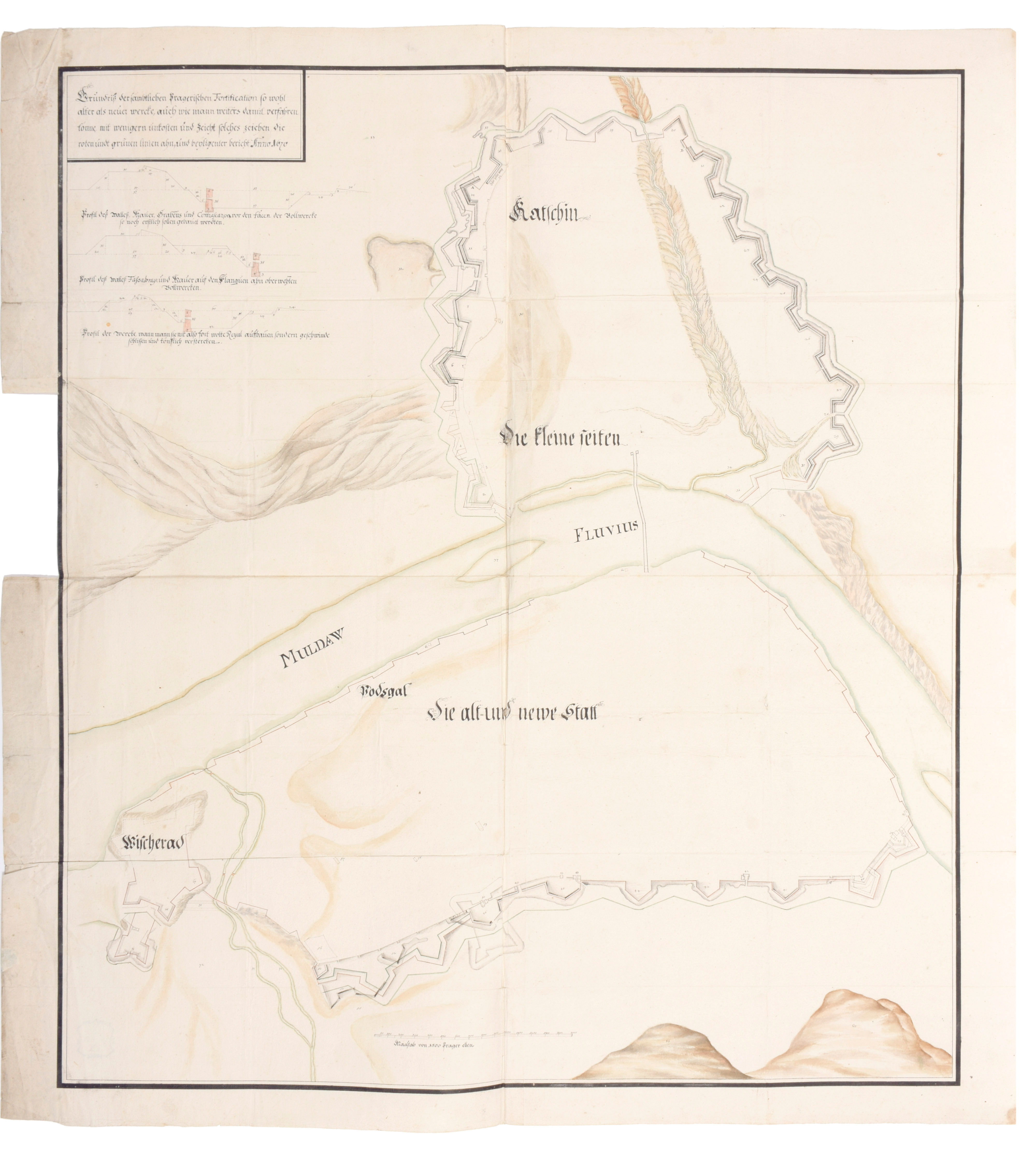
"""Gründrijss der jambtlichen Pragerischen Fortification..."""
1670
€500 - €800

Manuscript map 890 x 821 mm, with ink and watercolour, drawn on paper. The map contains a scale, a little legend and some profiles of the defenses. The map contains many details: ramparts, bridges, roads, rivers, relief etc. The map is made of four sheets of paper glued to each other. Some marginal stains, some marginal tears, some slight tears in foldings

The map shows the city of Prague in the year 1670 with on one side of the Vltava River (or Moldau) the Old and New Town (with the Vysehrad (or Wücherad) castle in the southern part) and on the other side the Prague Castle (or the Castle build on the Hradschin 'mountain'). The map shows the old ramparts as some ideas for improvements (see the red and green lines)