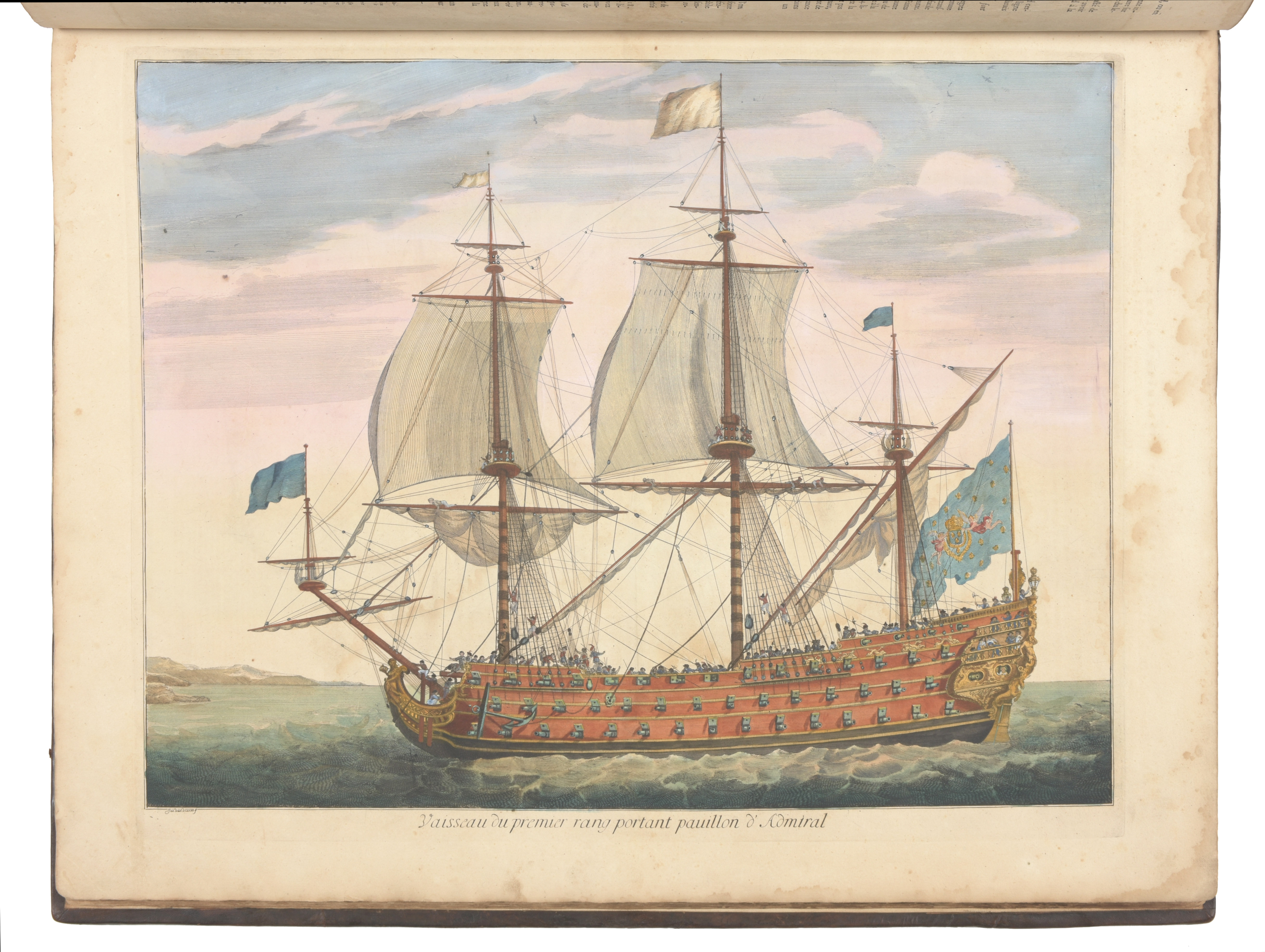
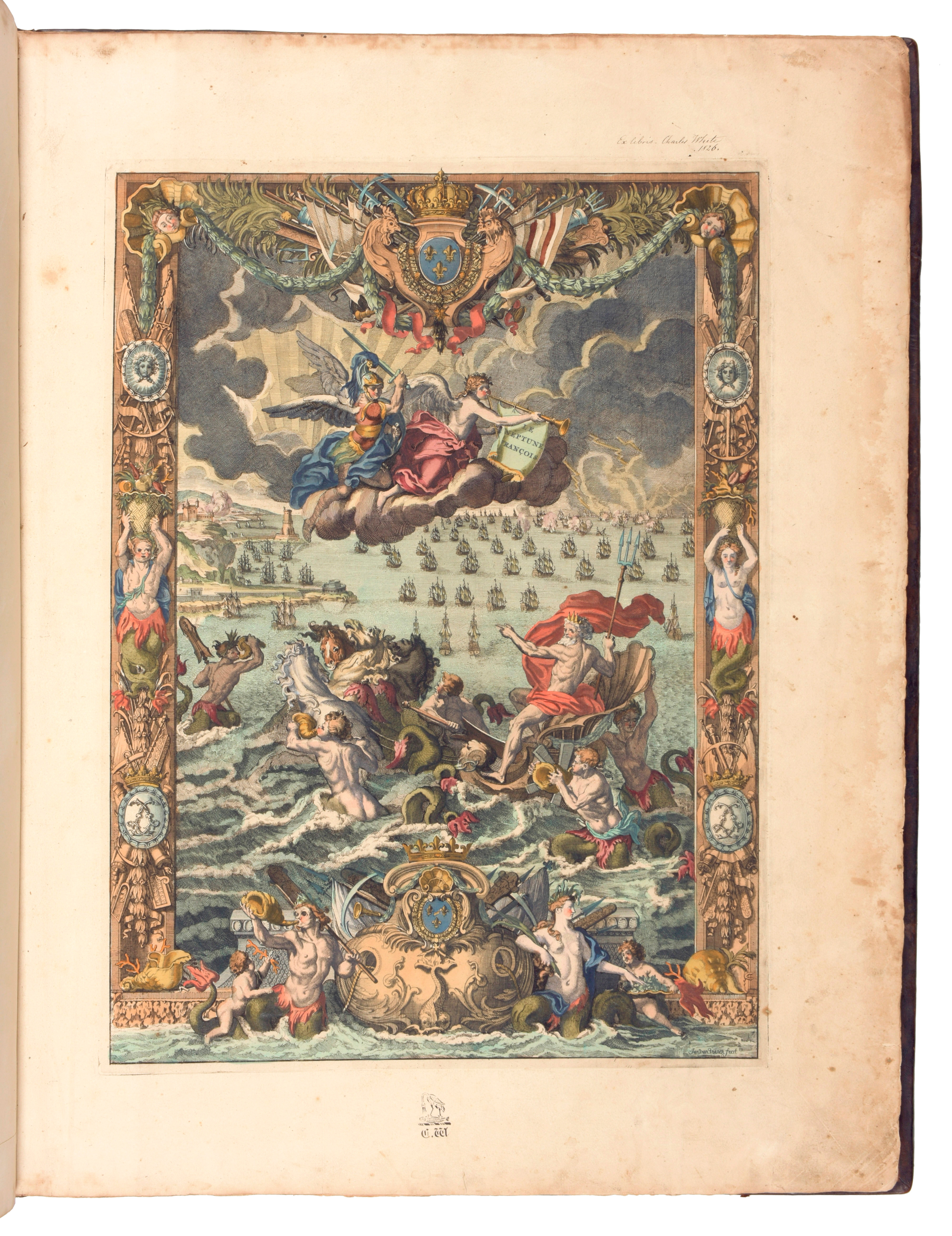
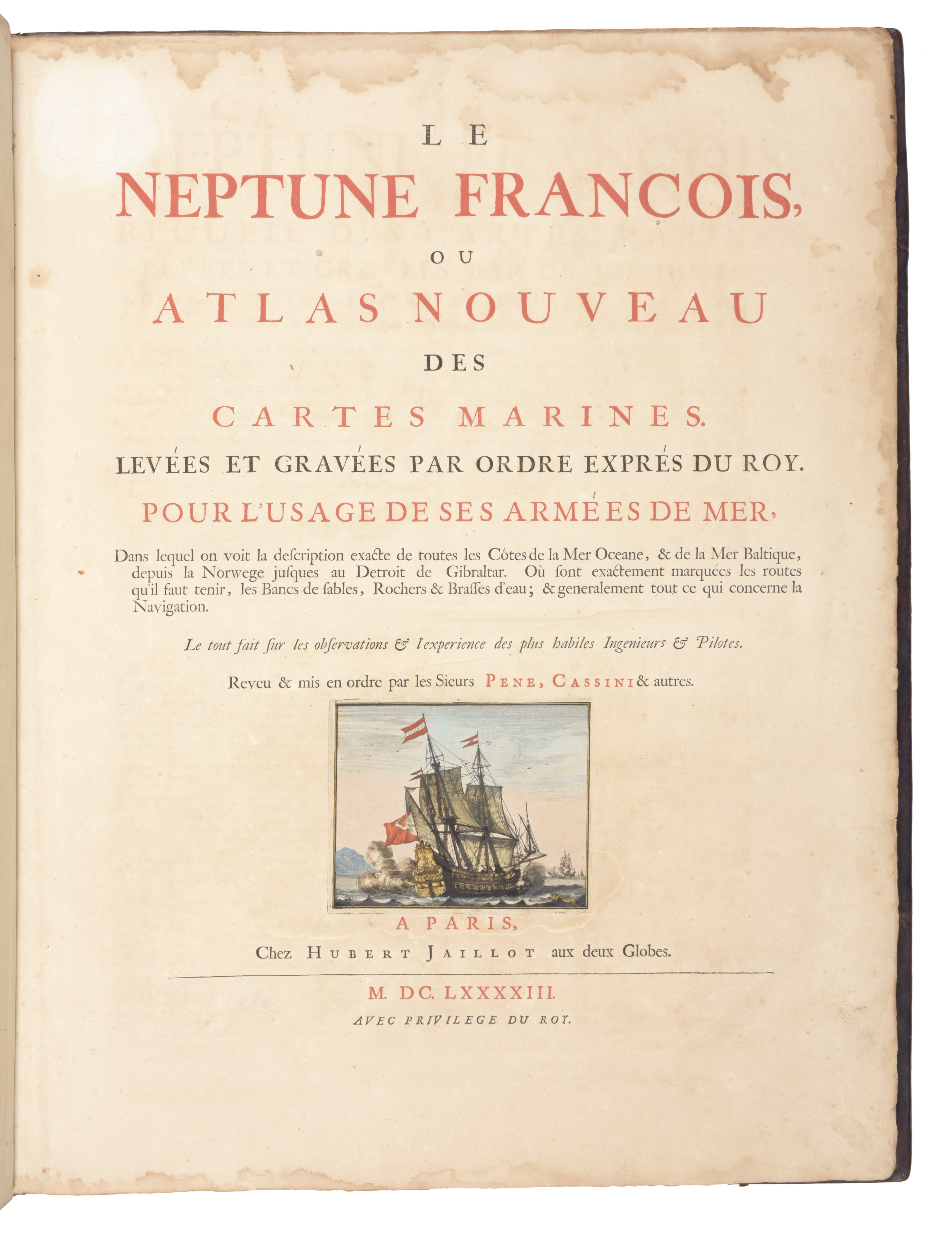
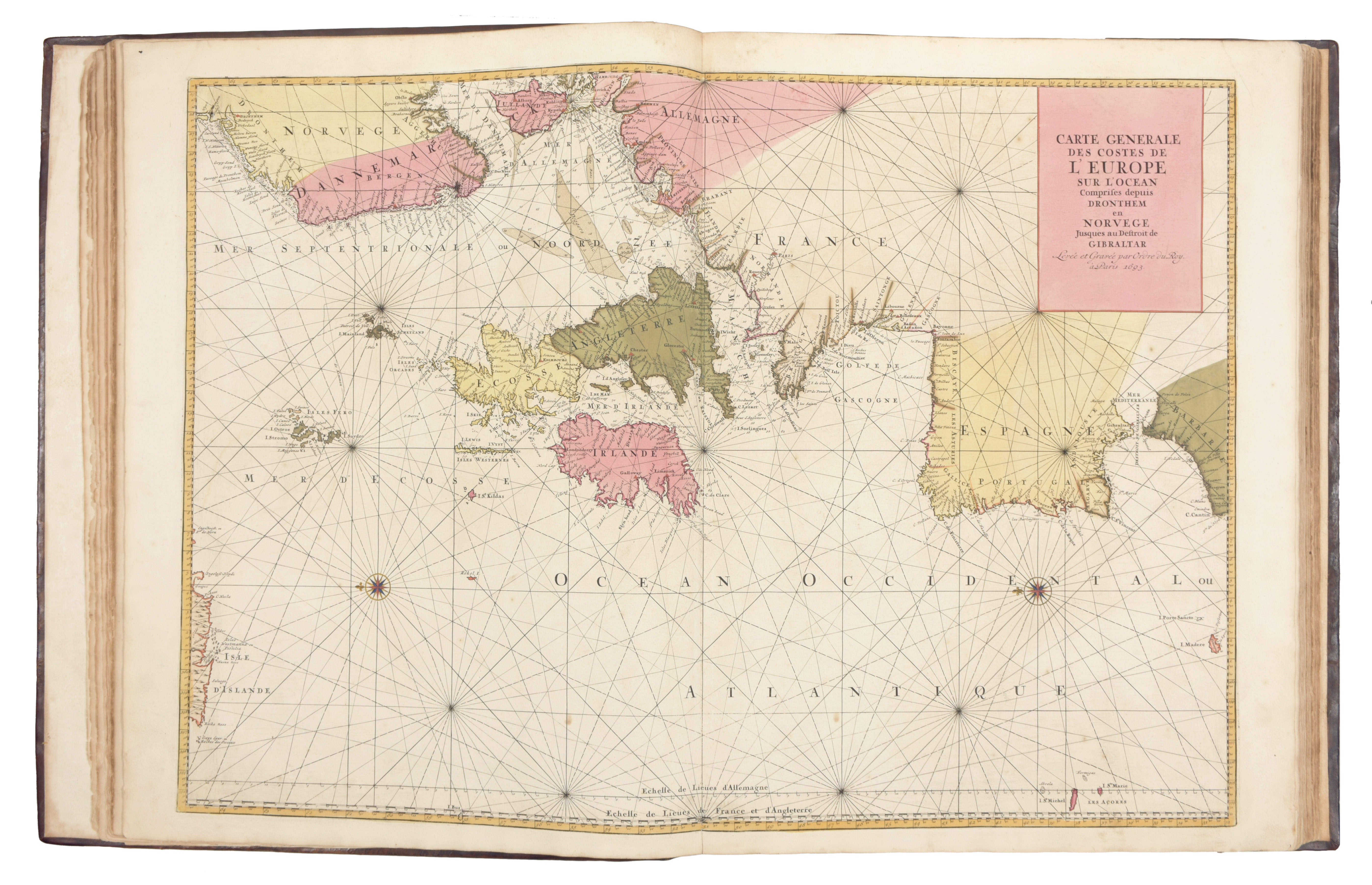
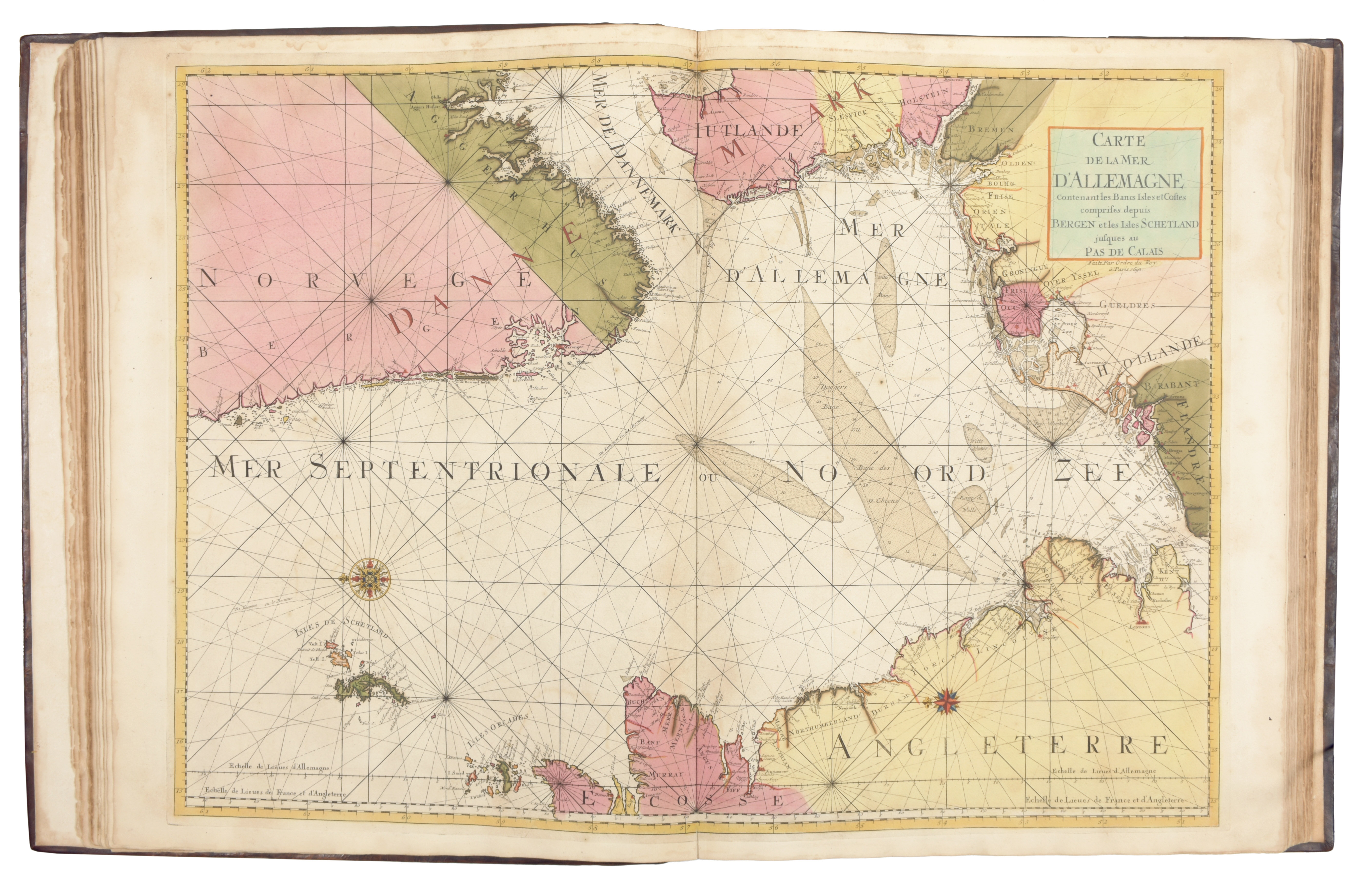
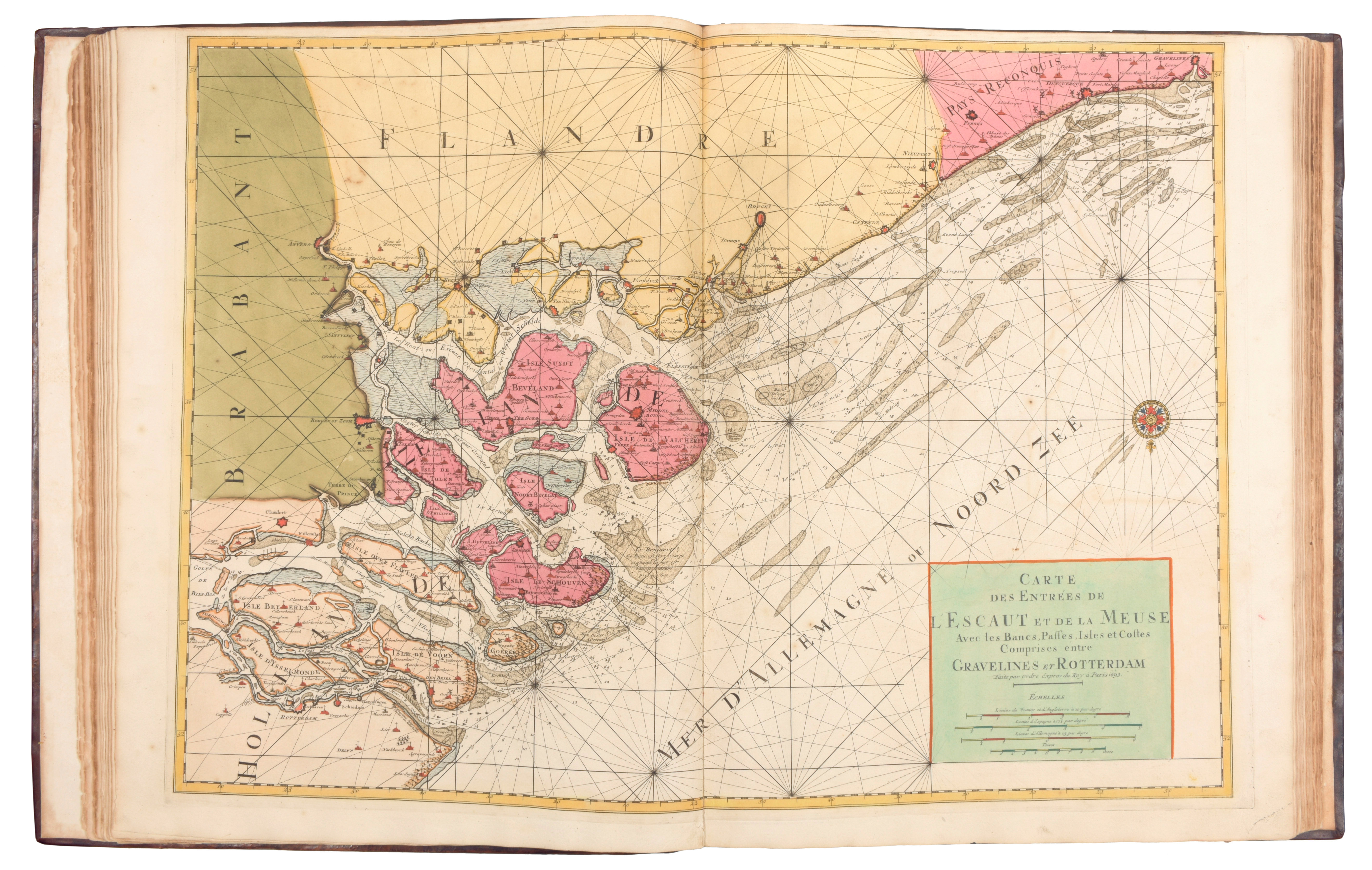
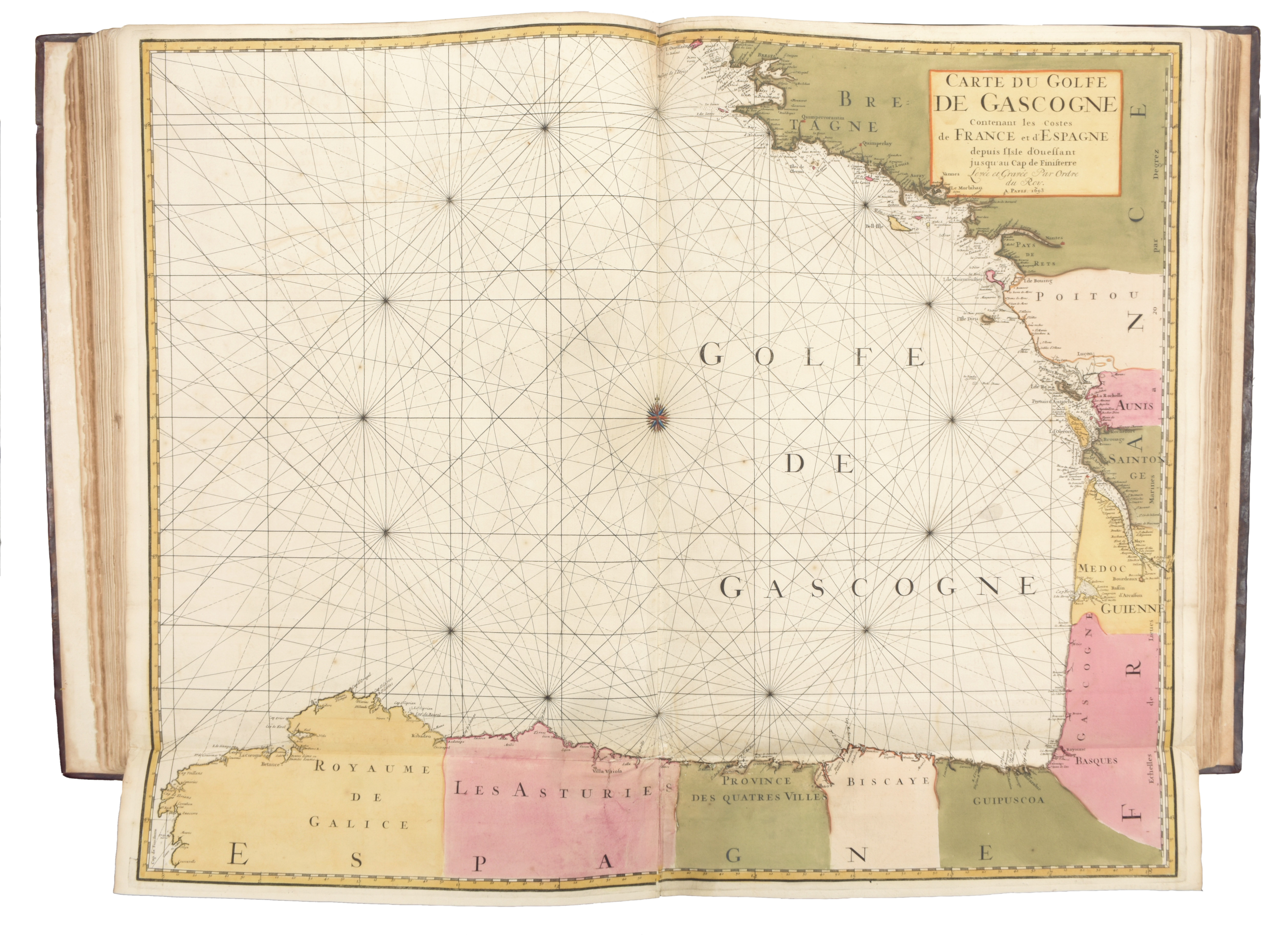
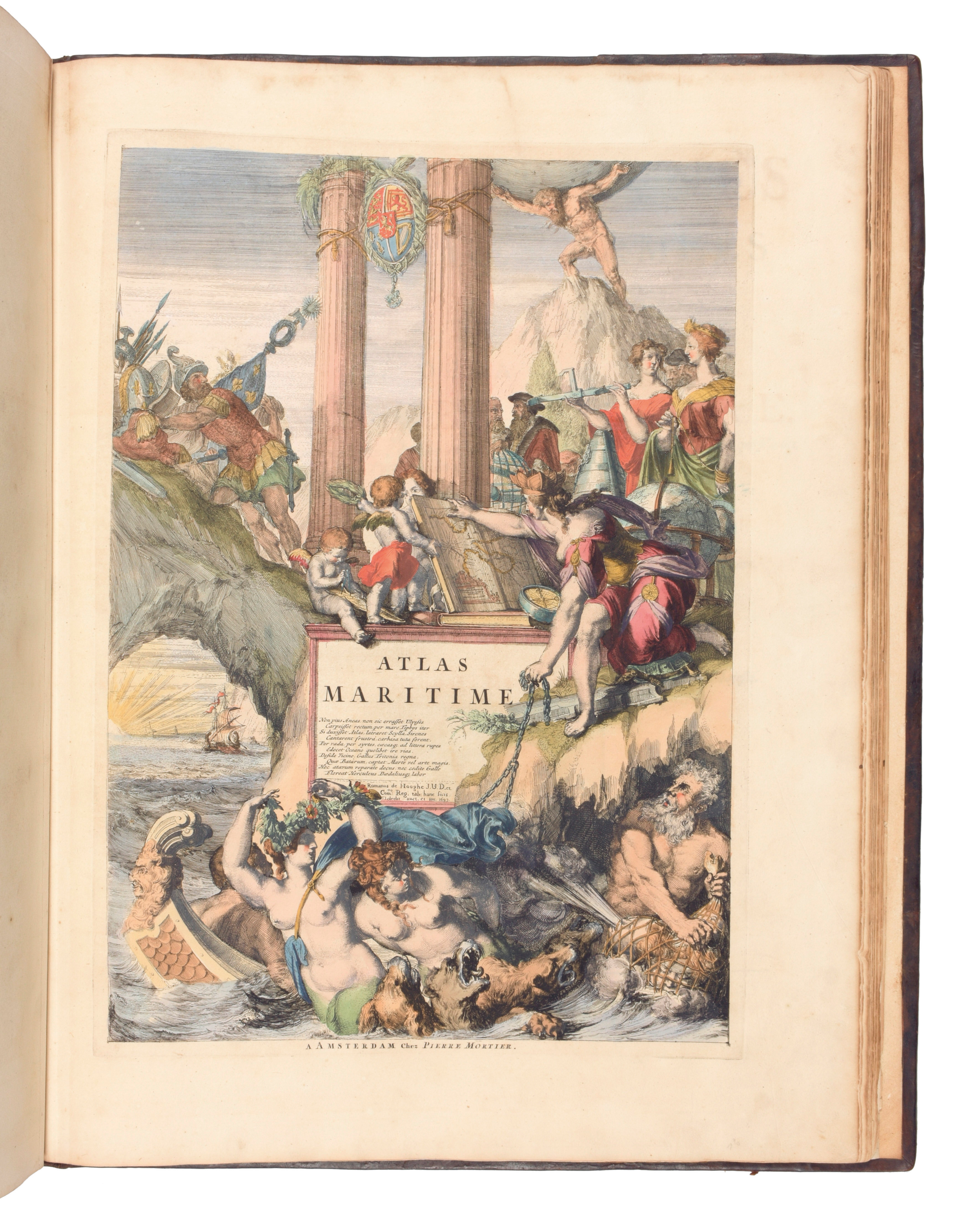
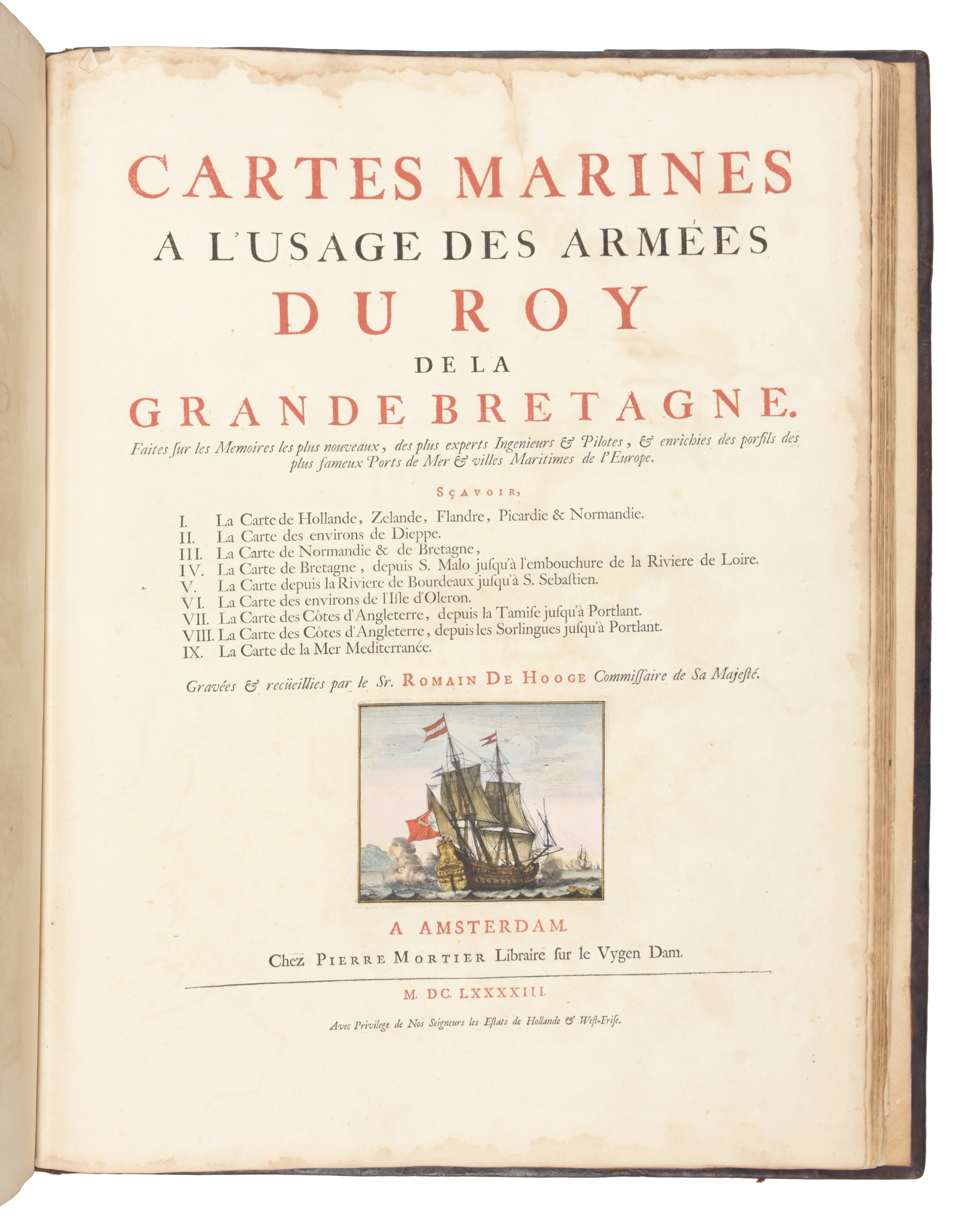
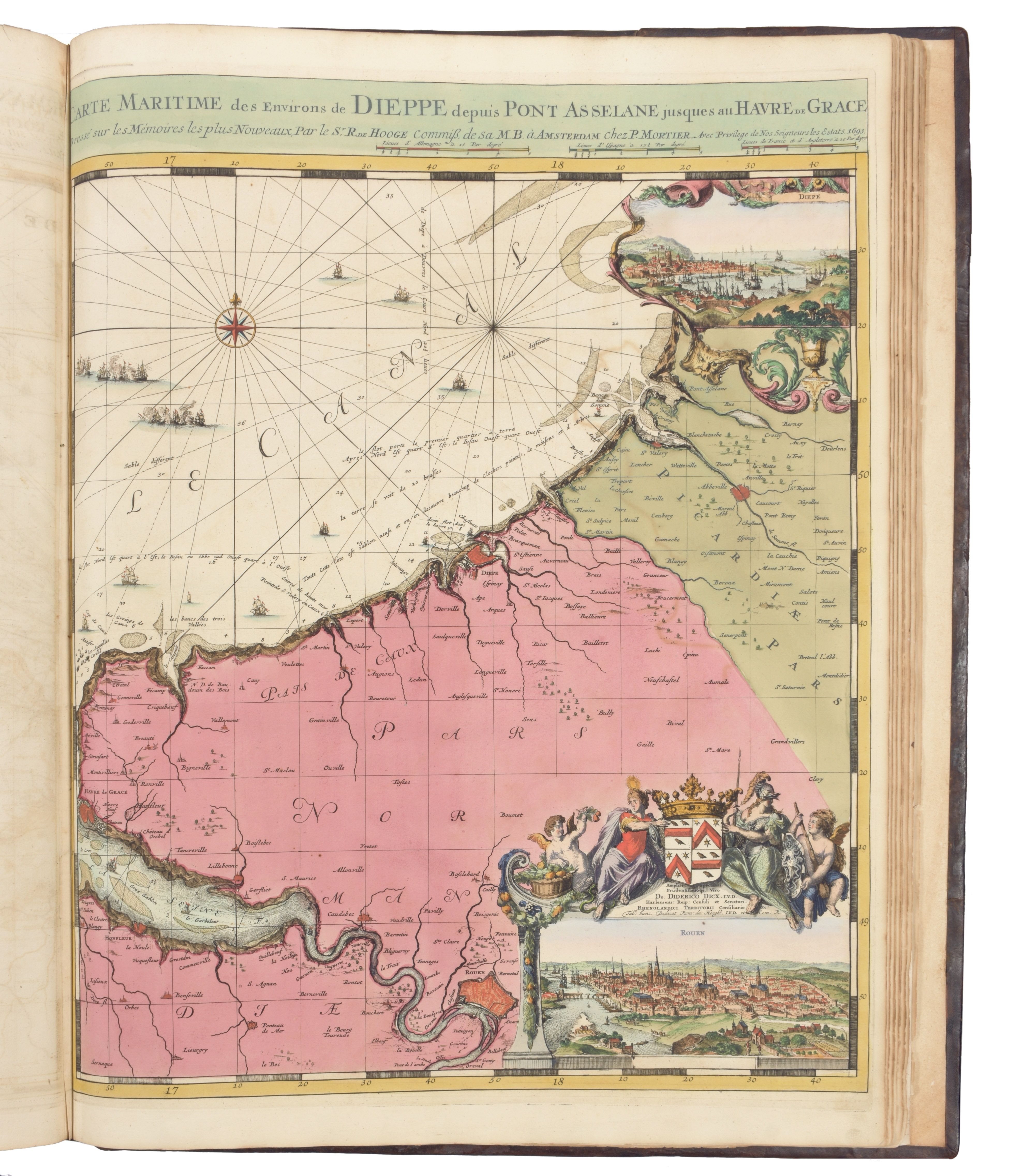
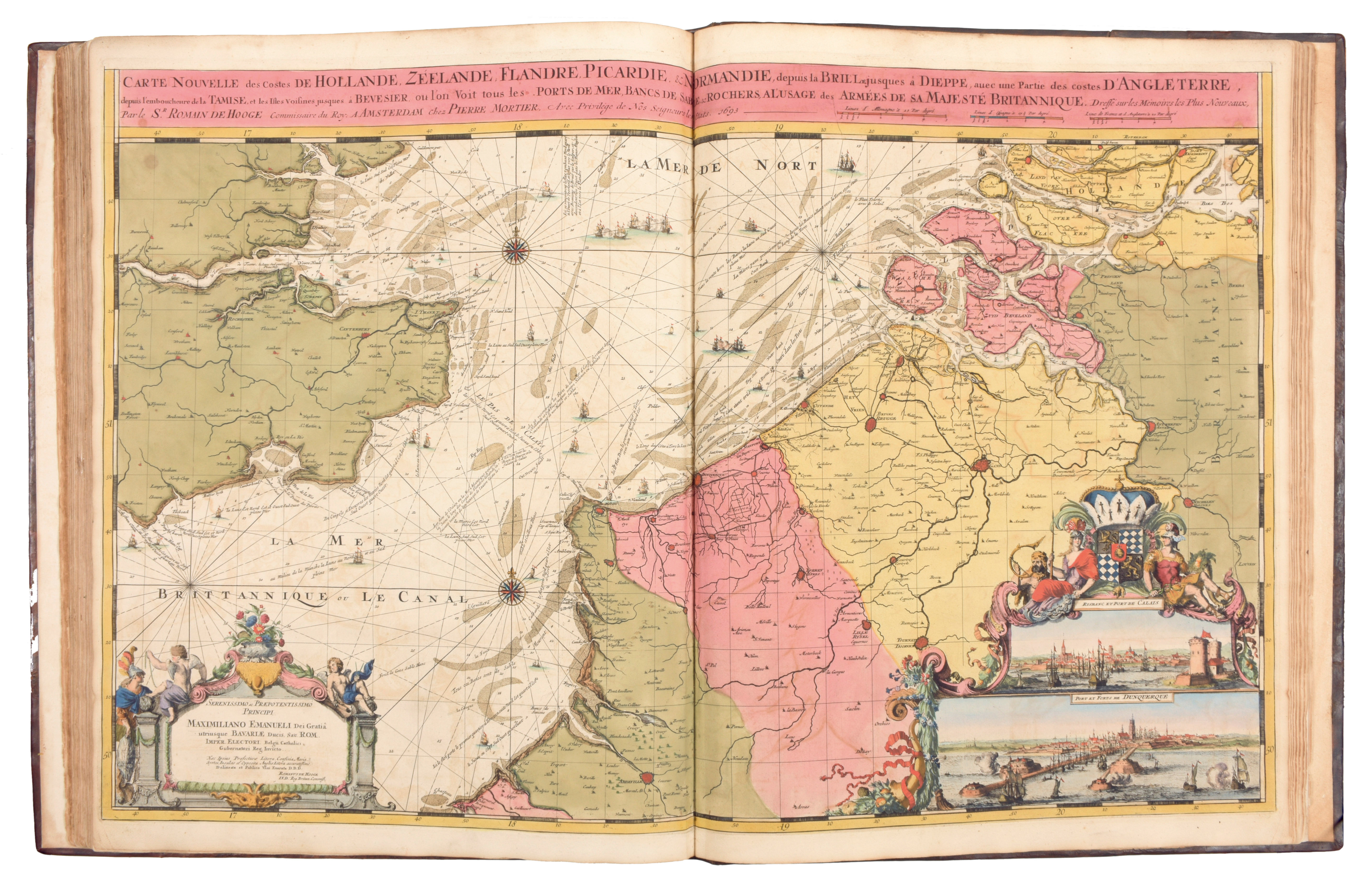
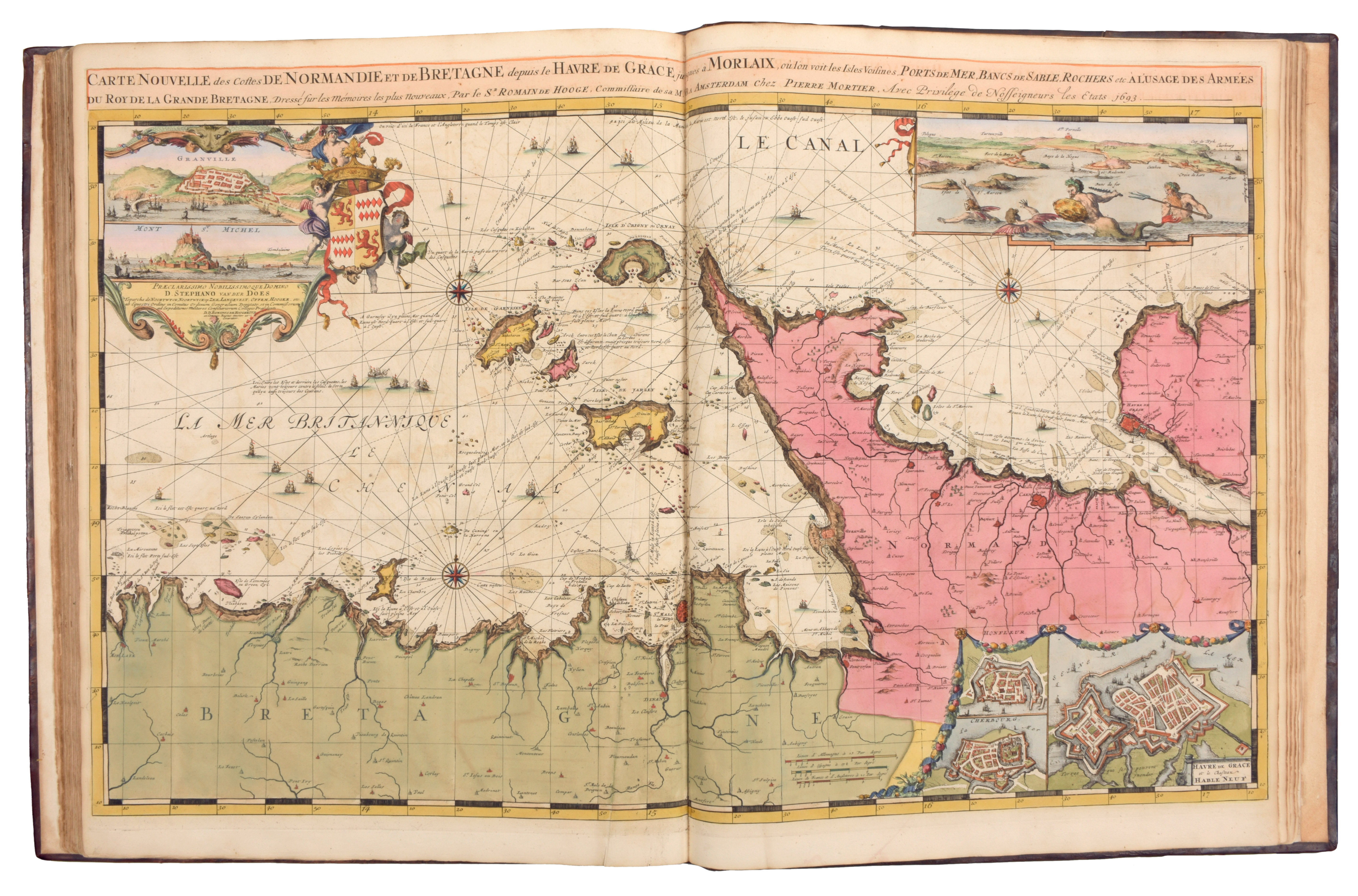
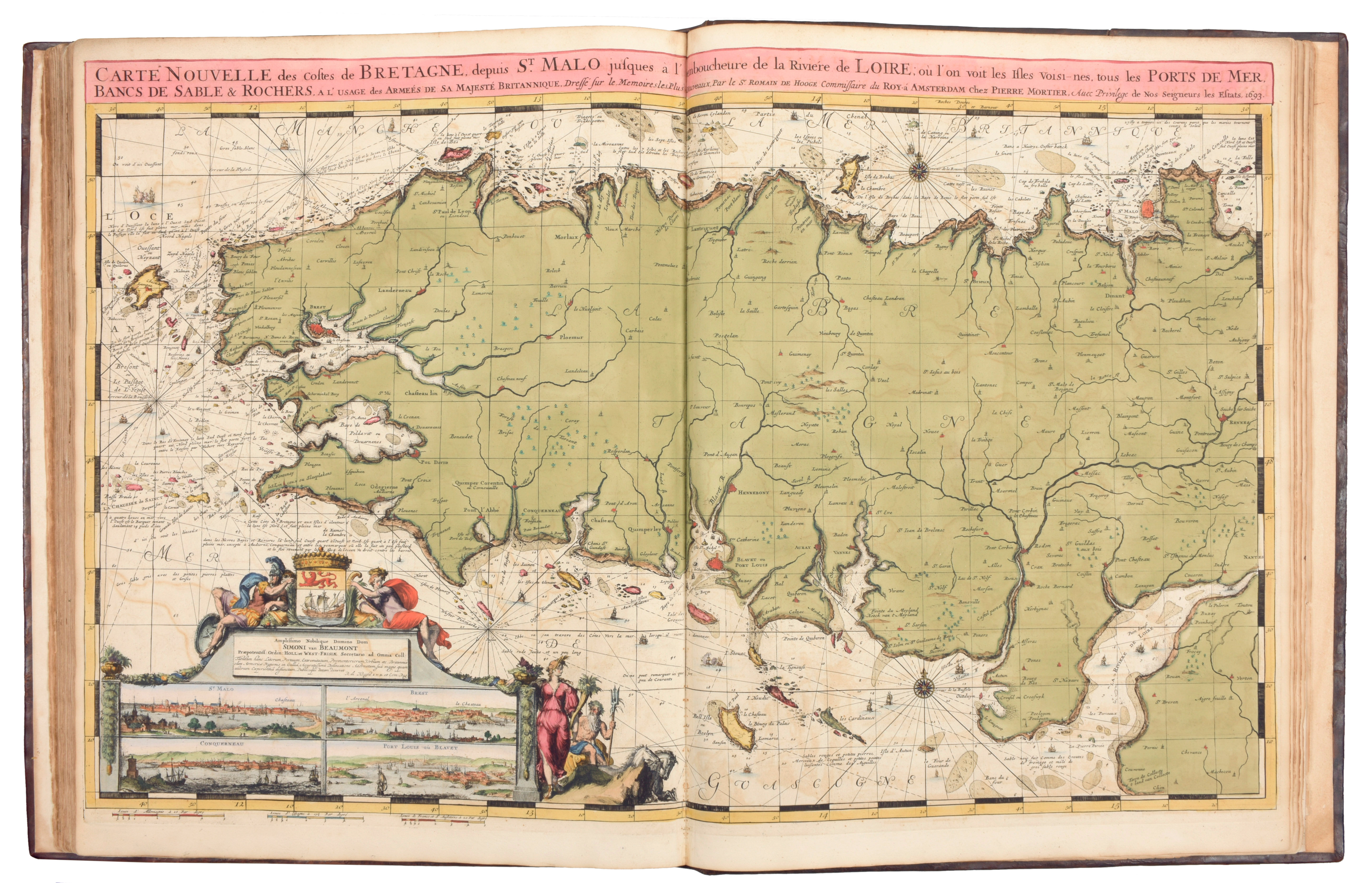
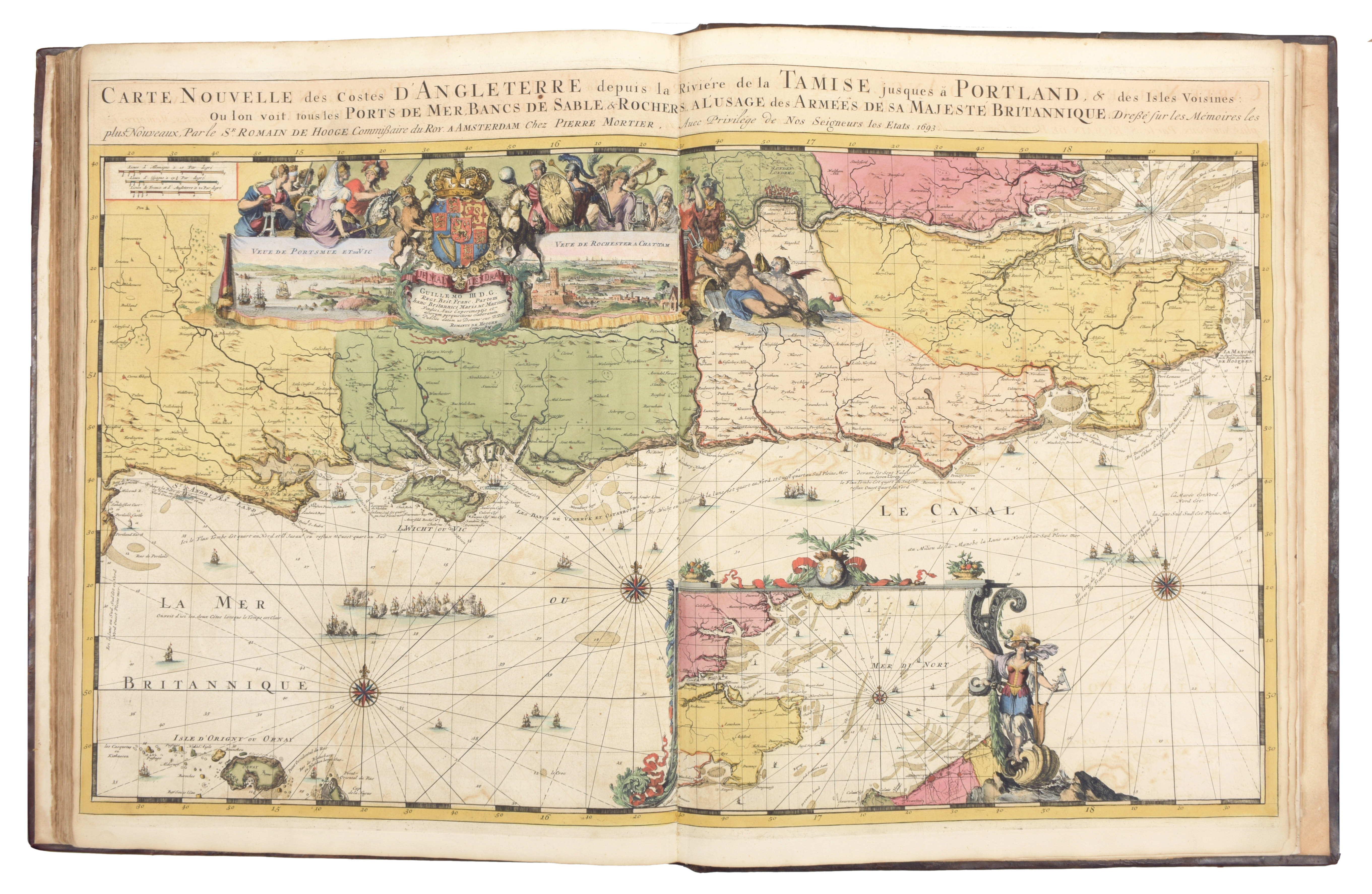
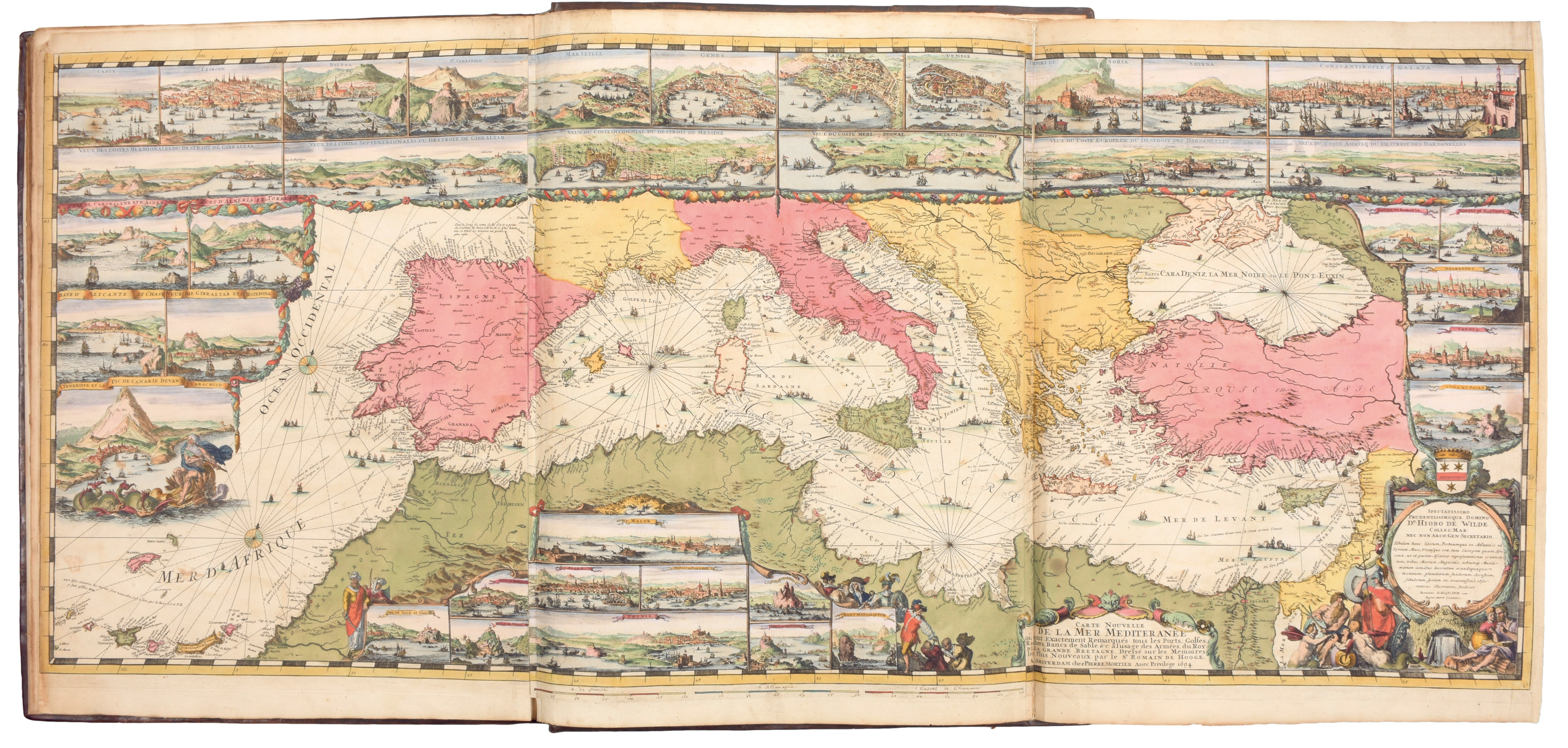
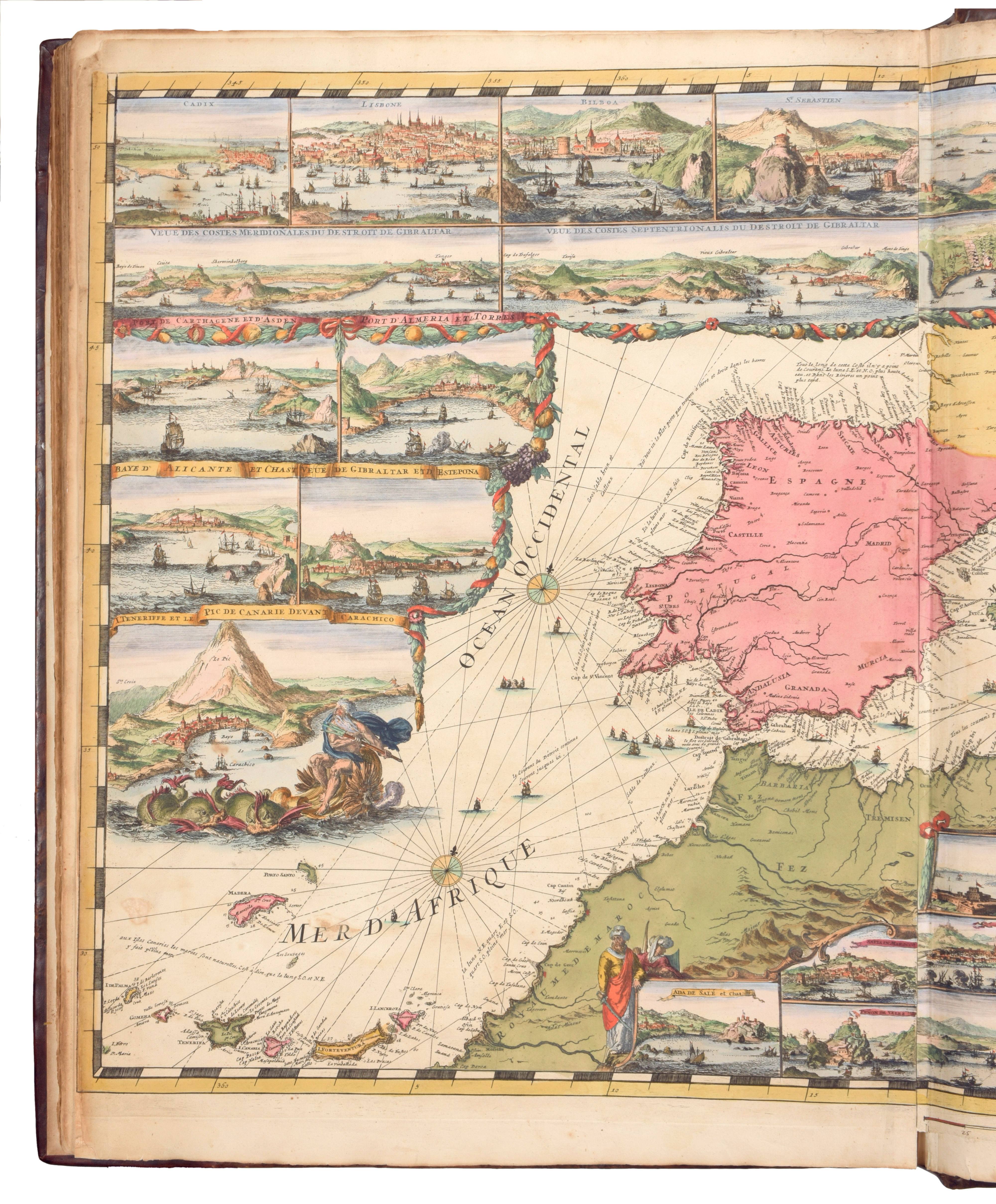
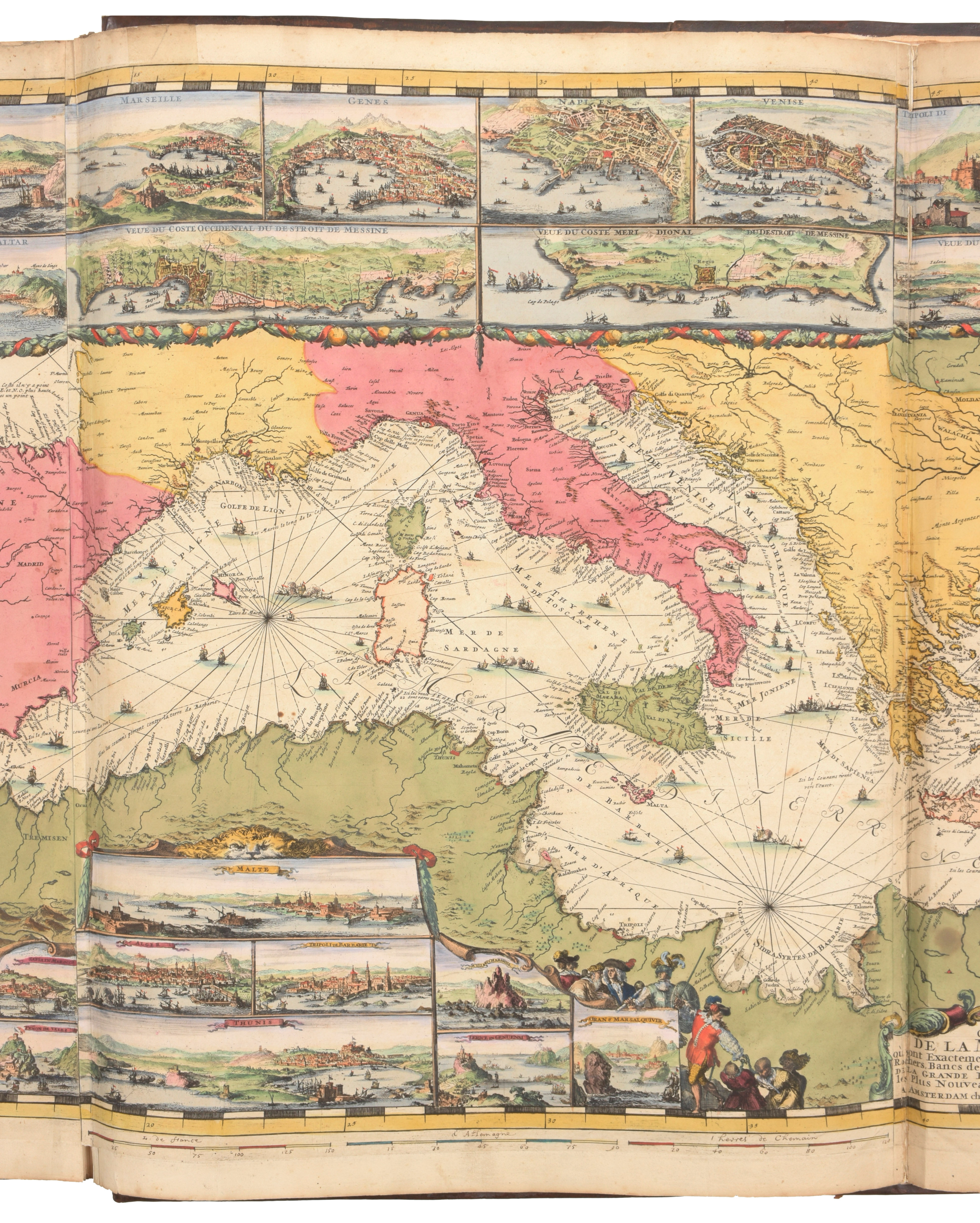
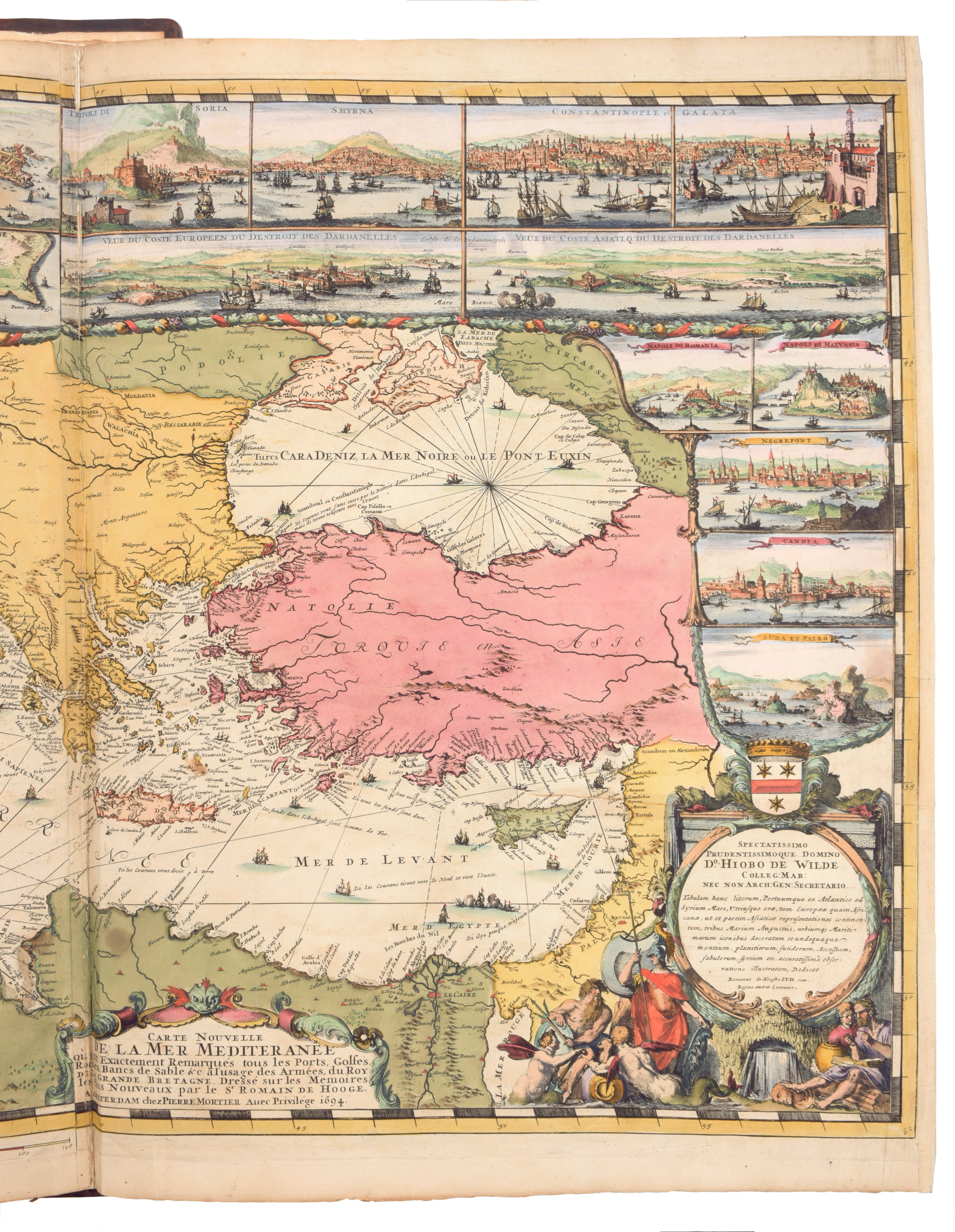
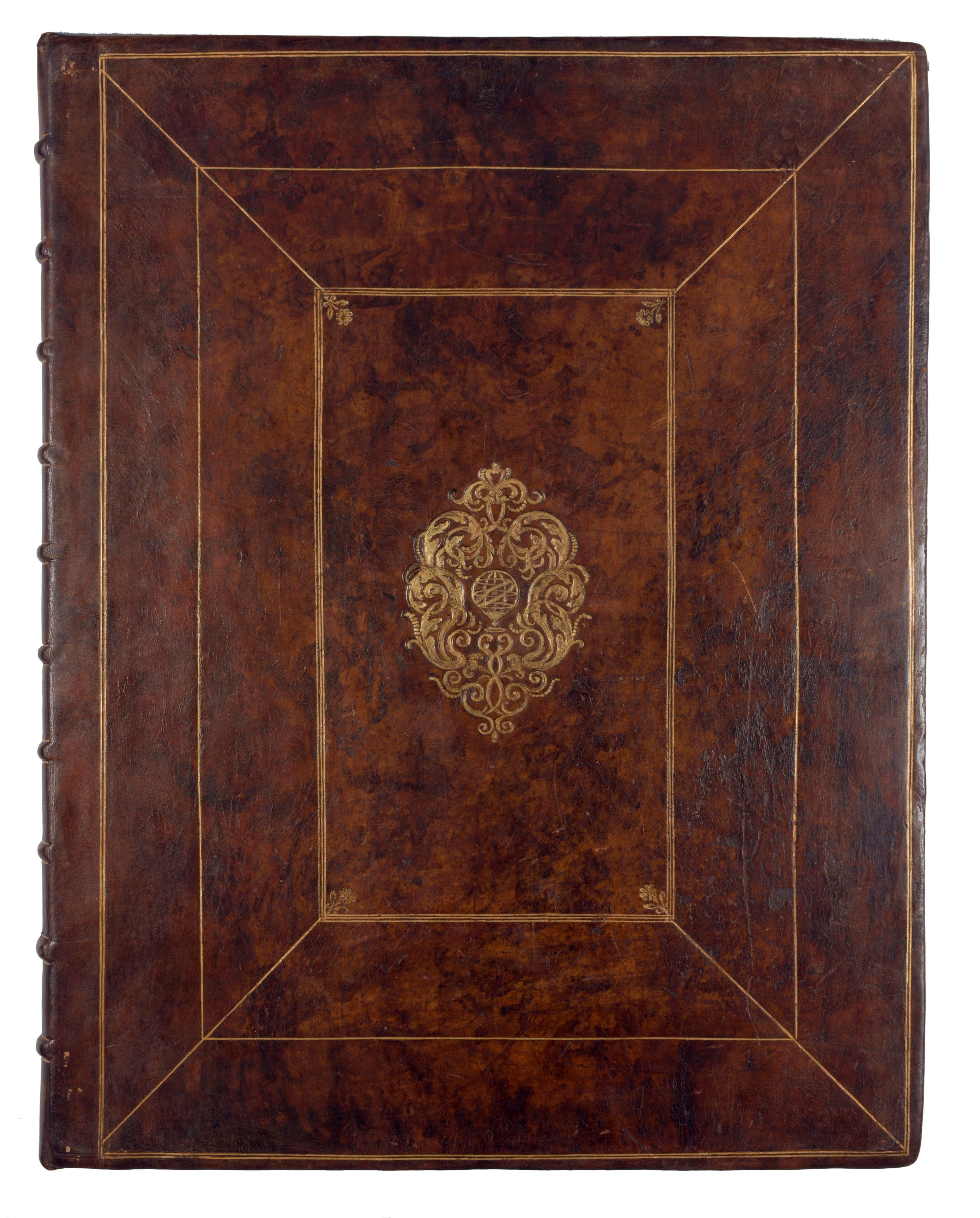
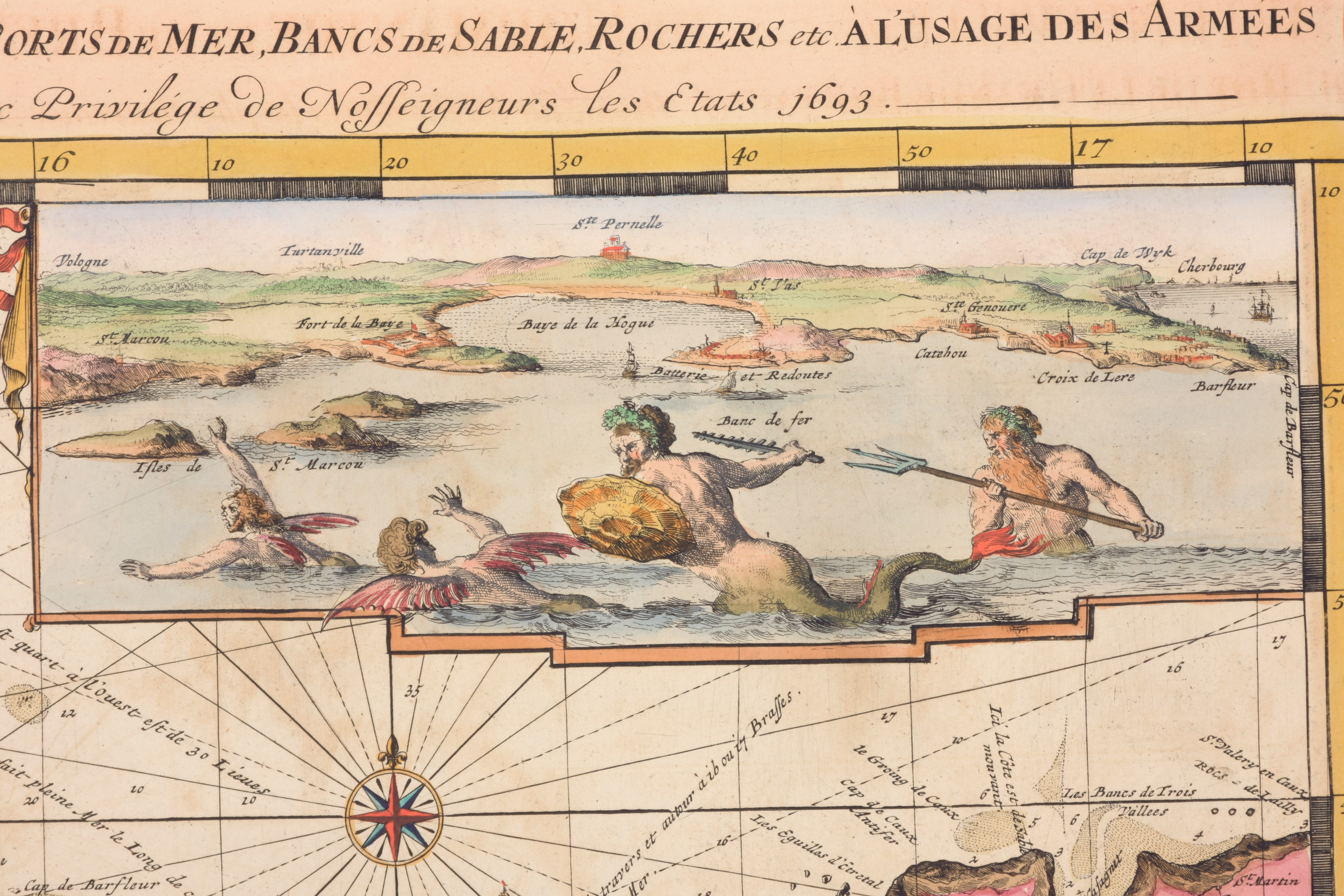
Atlas in-folio (64 x 50 cm), with 38 charts. - First part: Le Neptune françois: engraved title (by Jan Van Vianen after P. La Pautre and J. Berrin), typographical title with ship vignette, 6 text pages (index on page 6), 3 prints (vaisseau du premier rang portant pavillon d'Admiral, coupe d'un Amiral, coupe d'une Galère), page with 9 scales in 3 languages, 29 double engraved charts, all CONTEMPORARY HAND-COLOURED. The charts are covering the coasts of Europe, from Scandinavia and the Baltic coasts in the North to Gibraltar in the South, minus the Mediterranean. The charts are of French origin, 13 very detailed charts are of the French coasts. The 8 detailed maps of Bretagne were originally dressed by the marine engineer M. Denis de La Voye. The others were made by the French engineers Charles Pène et Jean Mathieu de Chazelles. - Second part: Atlas Maritime: allegorical etched title (R. de Hooghe), typographical title-page with ship vignette and with an index with the numbers I till IX., 9 large charts, all CONTEMPORARY HAND-COLOURED. These charts are of English origin. ""This volume is usually bound together with the first part. It only contains 9 large charts but this small number represents the most spectacular type of maritime cartography ever produced in 17th century Amsterdam. Contrary to the first part, these charts are of British origin but designed and etched by Romeyn de Hooghe. The large chart of the Mediterranean bears a privilegio dated 1694, which suggests that the edition was not published before 1694. The folding chart of the Mediterranean has 38 views of harbours."" A third part Suite du Neptune françois, with charts of the outer European waters, published in 1700, is not present here. Condition: in very good condition. Outer margin of frontispiece a little worn, title and first ship plate waterstained at upper margin, text leaves browned, 4th map of Brittany spotted, light offsetting. The last folding chart was reinforced in the folding, clear tear (24 cm) skillfully repaired, some small marginal tears repaired. Contemporary calf binding, gilt-panelled covers displaying an armillary sphere within a central cartouche, by the Amsterdam Quatrefoil binding, spine skillfully renewed, some restoration at edges
Provenance: Charles White, 1826 (inscription at head of frontispiece and monogram crest at foot) Ref. Storm van Leeuwen Dutch Decorated Bookbinding, vol. I, p. 216, vol. III, p. 670. Ref. cat. NHSM p. 51. Ref. Mireille Pastoureau, ""Les Atlas français (XVIe-XVIIe siècles)"" (1984), p.354, Neptune Français Ba, contrefaçon 1693. Ref. Koeman Atlantes Neerl. 4, p. 425-428, M. Mor 1 & M. Mor 5. ""The Neptune François and its second part Cartes Marines was the most expensive sea-atlas ever published in Amsterdam in the 17th century. Its charts are larger and more lavishly decorated than those of any preceding book of this kind. For the engraving and etching Mortier had recruited the most qualified artists. Romeyn de Hooghe did the decorations on the charts of the second part. This magnificent work was intended more as a show-piece rather than something to be used by the pilots at sea"" This successful atlas appeared simultaneously with a Dutch and with an English title: De Fransche Neptunus of Nieuwe Atlas van de Zeekaarten / The French Neptune or a New Atlas of Sea Charts. About the publisher Pieter Mortier: he was the son of a political refugee from France, and became a mapmaker and engraver. He won the privilege in 1690 of publishing maps and atlases by French publishers in Amsterdam for the Dutch market. Pieter Mortier counterfeited the original Neptune François (that was published by the Imprimerie Royale): he had all the plates very precisely re-engraved, but to the titles was added: ""levée et gravé par Ordre du Roy, à Paris"". The title page mentions Hubert Jaillot in Paris as the publisher, in fact Jaillot was Mortier's joint-publisher. The name of Paris on the title-page was only to promote the sales. Dedicated to King Willem III from England: the second part is ""à l'usage des Armées du Roy de la Grande Bretagne"". King Willem III was a protestant king from Dutch descent, he had no children but was very preoccupied with propaganda. This lavishly decorated sea-atlas was part of his propaganda. About the artist Romeyn de Hooghe: he was a Baroque painter, engraver and caricaturist. He was enlisted by William III at the end of the 17th century in his relentless war against the French monarch. Cette contrefaçon hollandaise du ""Neptune"" était destinée à être exportée et c'est pourquoi elle était dotée de la fausse adresse d'Alexis-Hubert Jaillot, à Paris, ""Aux deux globes"". La contrefaçon hollandaise eut l'avantage d'être plus complète que l'édition française: Mortier la fit suivre d'une partie inédite : l'""Atlas Maritime"" ou ""Cartes marines à l'usage des armées du roy de la Grande Bretagne"" (1693), tiré de cartes anglaises. Toutes les planches furent à cette occasion regravées aux Pays-Bas, avec beaucoup de fidélité mais aussi quelque raideur et des tracés plus gras. Trois gravures de navires furent ajoutées au recueil et le tableau des échelles fut traduit en hollandais et en anglais (ref. Gallica, BNF)